Dmitriyevka geodata
Dmitriyevka (Altai) is a populated place; located in Russia in Asia/Barnaul (GMT+7) time zone. With population of 600 people, there are 4880 cities with bigger population in this country. Compared to other cities in Russia, 66.6% of cities are located further ↑North; 84.5% of cities are located further ←West and 82.5% of cities have lower elevation than Dmitriyevka. Note1


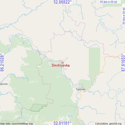
Dmitriyevka GPS coordinates[2]
52° 26' 30.12" North, 86° 54' 48.24" East
| Map corner | latitude | longitude |
|---|---|---|
| Upper-left | 52.86822°, | 86.21028° |
| Center: | 52.4417°, | 86.9134° |
| Lower-right: | 52.01101°, | 87.61653° |
| Map W x H: | 95.3×95.3 km | = 59.2×59.2mi |
| max Lat: | 73.50819° ⇑66.6% North |
| Dmitriyevka: | 52.4417° |
| min Lat: | ⇓33.4% South 41.28413° |
| min Long | Dmitriyevka | max Long |
| -179.12198° | 86.9134° | 179.35046° |
| W 84.5%⇐ | ⇒15.5% E |
Elevation
Elevation of Dmitriyevka is 279 m = 915 ft, and this is 76.4 m = 251 ft above average elevation for this country.
| Max E: |
2518 m = 8261 ft | 17.5% |
| Dmitriyevka | 279 m 915 ft | |
| Avg. | 202.6 m = 665 ft | |
Min E: |
-28 m = -92 ft | 82.5% |
See also: Russia elevation on elevation.city.
Geographical zone
Dmitriyevka is located in North temperate zone (between Tropic of Cancer and the Arctic Circle). Distance of this North polar circle is 1570.2 km =975.7 mi to North.| Distance of | km | miles | from Dmitriyevka |
|---|---|---|---|
| North Pole | 4176.1 | 2594.9 | to North |
| Arctic Circle | 1570.2 | 975.7 | to North |
| Tropic Cancer | 3225.1 | 2004 | to South |
| Equator | 5831 | 3623.2 | to South |


Nearby cities:
15 places around Dmitriyevka: (largest is in red/bold)
• Berëzovka
74.4 km =46.2 mi,  262°
262°
• Bystryanka
75.7 km =47 mi, 256°
• Choya
54 km =33.6 mi,  207°
207°
• Chugunash
75.8 km =47.1 mi,  50°
50°
• Karabinka
52.5 km =32.6 mi,  301°
301°
• Kaz
58.7 km =36.5 mi,  27°
27°
• Krasnogorskoye
51.2 km =31.8 mi,  251°
251°
• Neninka
54.8 km =34.1 mi, 298°
• Novikovo
67.3 km =41.8 mi,  287°
287°
• Solton
53.4 km =33.2 mi,  326°
326°
• Souskanikha
65.8 km =40.9 mi,  282°
282°
• Spassk
66.2 km =41.1 mi,  59°
59°
• Tashtagol
75.1 km =46.7 mi, 61°
• Turochak
24.9 km =15.5 mi,  145°
145°
• Ust’-Isha
70.5 km =43.8 mi, 245°
Sources, notices
• [Note1] Compared only with cities in Russia existing in our database
• [Src1] Map data: © OpenStreetMap contributors (CC-BY-SA)
• [Src2] Other city data from geonames.org with taken over terms of usage.
• [Src3] Geographical zone / Annual Mean Temperature by Robert A. Rohde @ Wikipedia
