Chugunash geodata
Chugunash (Kemerovo Oblast) is a populated place; located in Russia in Asia/Novokuznetsk (GMT+7) time zone. With population of 657 people, there are 4850 cities with bigger population in this country. Compared to other cities in Russia, 63.6% of cities are located further ↑North; 85% of cities are located further ←West and 89.4% of cities have lower elevation than Chugunash. Note1


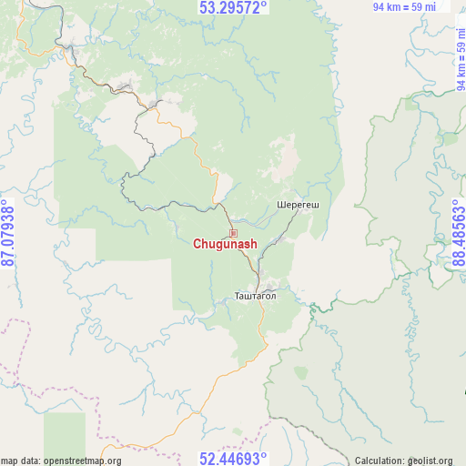
Chugunash GPS coordinates[2]
52° 52' 24.24" North, 87° 46' 57" East
| Map corner | latitude | longitude |
|---|---|---|
| Upper-left | 53.29572°, | 87.07938° |
| Center: | 52.8734°, | 87.7825° |
| Lower-right: | 52.44693°, | 88.48563° |
| Map W x H: | 94.4×94.4 km | = 58.7×58.7mi |
| max Lat: | 73.50819° ⇑63.6% North |
| Chugunash: | 52.8734° |
| min Lat: | ⇓36.4% South 41.28413° |
| min Long | Chugunash | max Long |
| -179.12198° | 87.7825° | 179.35046° |
| W 85%⇐ | ⇒15% E |
Elevation
Elevation of Chugunash is 439 m = 1440 ft, and this is 236.4 m = 776 ft above average elevation for this country.
| Max E: |
2518 m = 8261 ft | 10.6% |
| Chugunash | 439 m 1440 ft | |
| Avg. | 202.6 m = 665 ft | |
Min E: |
-28 m = -92 ft | 89.4% |
See also: Russia elevation on elevation.city.
Geographical zone
Chugunash is located in North temperate zone (between Tropic of Cancer and the Arctic Circle). Distance of this North polar circle is 1522.2 km =945.9 mi to North.| Distance of | km | miles | from Chugunash |
|---|---|---|---|
| North Pole | 4128.1 | 2565.1 | to North |
| Arctic Circle | 1522.2 | 945.9 | to North |
| Tropic Cancer | 3273.1 | 2033.8 | to South |
| Equator | 5879 | 3653 | to South |


Nearby cities:
15 places around Chugunash: (largest is in red/bold)
• Dmitriyevka
75.8 km =47.1 mi,  230°
230°
• Kaltan
81.8 km =50.8 mi,  334°
334°
• Kaz
31.9 km =19.8 mi,  277°
277°
• Kuzedeyevo
63.9 km =39.7 mi,  322°
322°
• Mezhdurechensk
93.1 km =57.8 mi,  11°
11°
• Mundybash
49.6 km =30.8 mi, 319°
• Myski
92.9 km =57.7 mi,  0°
0°
• Osinniki
88.1 km =54.7 mi,  341°
341°
• Sheregesh
14.7 km =9.1 mi,  68°
68°
• Solton
87.6 km =54.4 mi,  267°
267°
• Spassk
14.2 km =8.8 mi,  187°
187°
• Tashtagol
14 km =8.7 mi,  149°
149°
• Tayzhina
91.3 km =56.7 mi,  345°
345°
• Temirtau
36.7 km =22.8 mi, 323°
• Turochak
81.7 km =50.8 mi,  213°
213°
Sources, notices
• [Note1] Compared only with cities in Russia existing in our database
• [Src1] Map data: © OpenStreetMap contributors (CC-BY-SA)
• [Src2] Other city data from geonames.org with taken over terms of usage.
• [Src3] Geographical zone / Annual Mean Temperature by Robert A. Rohde @ Wikipedia
