Hafar Al-Batin geodata
Hafar Al-Batin (Eastern Province) is a populated place; located in Saudi Arabia in Asia/Riyadh (GMT+3) time zone. With population of 271,642 people, there are 13 cities with bigger population in this country. Compared to other cities in Saudi Arabia, 92.8% of cities are located further ↓South; 64.9% of cities are located further ←West and 52.6% of cities have higher elevation than Hafar Al-Batin. Note1


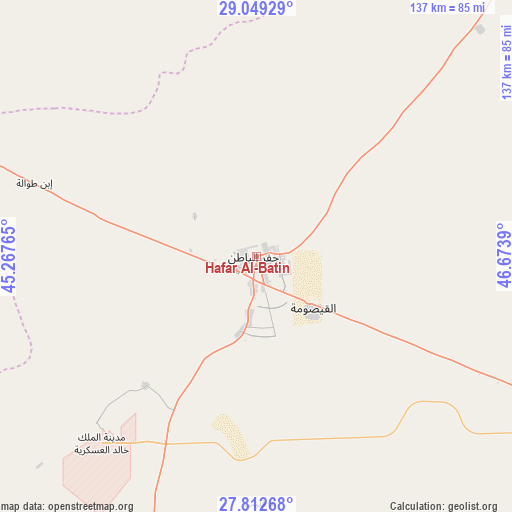
Hafar Al-Batin GPS coordinates[2]
28° 25' 58.044" North, 45° 58' 14.772" East
| Map corner | latitude | longitude |
|---|---|---|
| Upper-left | 29.04929°, | 45.26765° |
| Center: | 28.43279°, | 45.97077° |
| Lower-right: | 27.81268°, | 46.6739° |
| Map W x H: | 137.5×137.5 km | = 85.4×85.4mi |
| max Lat: | 31.67252° ⇑7.2% North |
| Hafar Al-Batin: | 28.43279° |
| min Lat: | ⇓92.8% South 16.57946° |
| min Long | Hafar Al-Batin | max Long |
| 35.69014° | 45.97077° | 54.09599° |
| W 64.9%⇐ | ⇒35.1% E |
Elevation
Elevation of Hafar Al-Batin is 310 m = 1017 ft, and this is 211.4 m = 694 ft below average elevation for this country.
| Max E: |
2385 m = 7825 ft | 52.6% |
| Avg. | 521.4 m = 1711 ft | |
| Hafar Al-Batin | 310 m = 1017 ft | |
Min E: |
3 m = 10 ft | 47.4% |
See also: Hafar Al-Batin elevation on elevation.city.
Geographical zone
Hafar Al-Batin is located in North temperate zone (between Tropic of Cancer and the Arctic Circle). Distance of this Northern Tropic circle is 555.5 km =345.2 mi to South.| Distance of | km | miles | from Hafar Al-Batin |
|---|---|---|---|
| North Pole | 6845.6 | 4253.7 | to North |
| Arctic Circle | 4239.7 | 2634.4 | to North |
| Tropic Cancer | 555.5 | 345.2 | to South |
| Equator | 3161.4 | 1964.4 | to South |


Nearby cities:
15 places around Hafar Al-Batin: (largest is in red/bold)
• Al Arţāwīyah
223.1 km =138.6 mi,  195°
195°
• Al Bukayrīyah
342.4 km =212.8 mi,  221°
221°
• Al Fuwayliq
347.7 km =216.1 mi,  230°
230°
• Al Khafjī
246.4 km =153.1 mi,  89°
89°
• Al Majma‘ah
286.9 km =178.3 mi,  192°
192°
• Al Mithnab
334.3 km =207.7 mi,  211°
211°
• Ar Rass
375.6 km =233.4 mi, 220°
• As Saffānīyah
275.2 km =171 mi,  100°
100°
• Az Zulfī
263.2 km =163.5 mi, 205°
• Buraydah
306.1 km =190.2 mi, 220°
• Mulayjah
273.6 km =170 mi,  118°
118°
• Qaisumah
20.4 km =12.7 mi,  131°
131°
• Tanūmah
233.7 km =145.2 mi, 230°
• Tumayr
303.6 km =188.6 mi,  181°
181°
• Unaizah
327.6 km =203.6 mi, 217°
Sources, notices
• [Note1] Compared only with cities in Saudi Arabia existing in our database
• [Src1] Map data: © OpenStreetMap contributors (CC-BY-SA)
• [Src2] Other city data from geonames.org with taken over terms of usage.
• [Src3] Geographical zone / Annual Mean Temperature by Robert A. Rohde @ Wikipedia
