Al-`Ula geodata
Al-`Ula (Al Madīnah al Munawwarah) is a populated place; located in Saudi Arabia in Asia/Riyadh (GMT+3) time zone. With population of 32,413 people, there are 46 cities with bigger population in this country. Compared to other cities in Saudi Arabia, 80.4% of cities are located further ↓South; 94.8% of cities are located further →East and 73.2% of cities have lower elevation than Al-`Ula. Note1


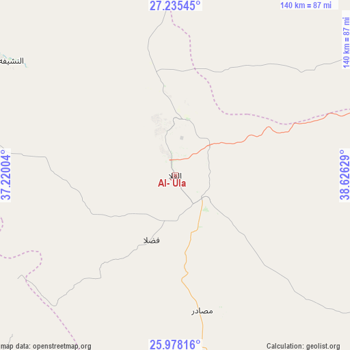
Al-`Ula GPS coordinates[2]
26° 36' 30.708" North, 37° 55' 23.376" East
| Map corner | latitude | longitude |
|---|---|---|
| Upper-left | 27.23545°, | 37.22004° |
| Center: | 26.60853°, | 37.92316° |
| Lower-right: | 25.97816°, | 38.62629° |
| Map W x H: | 139.8×139.8 km | = 86.9×86.9mi |
| max Lat: | 31.67252° ⇑19.6% North |
| Al-`Ula: | 26.60853° |
| min Lat: | ⇓80.4% South 16.57946° |
| min Long | Al-`Ula | max Long |
| 35.69014° | 37.92316° | 54.09599° |
| W 5.2%⇐ | ⇒94.8% E |
Elevation
Elevation of Al-`Ula is 692 m = 2270 ft, and this is 170.6 m = 560 ft above average elevation for this country.
| Max E: |
2385 m = 7825 ft | 26.8% |
| Al-`Ula | 692 m 2270 ft | |
| Avg. | 521.4 m = 1711 ft | |
Min E: |
3 m = 10 ft | 73.2% |
See also: Saudi Arabia elevation on elevation.city.
Geographical zone
Al-`Ula is located in North temperate zone (between Tropic of Cancer and the Arctic Circle). Distance of this Northern Tropic circle is 352.7 km =219.2 mi to South.| Distance of | km | miles | from Al-`Ula |
|---|---|---|---|
| North Pole | 7048.5 | 4379.7 | to North |
| Arctic Circle | 4442.6 | 2760.5 | to North |
| Tropic Cancer | 352.7 | 219.2 | to South |
| Equator | 2958.6 | 1838.4 | to South |


Nearby cities:
11 places around Al-`Ula: (largest is in red/bold)
• Al Wajh
151.9 km =94.4 mi,  254°
254°
• Badr Ḩunayn
326.1 km =202.6 mi,  164°
164°
• Duba
236.2 km =146.8 mi,  290°
290°
• Ha'il
386.6 km =240.2 mi,  74°
74°
• Medina
292.2 km =181.6 mi,  144°
144°
• Rābigh
438.3 km =272.3 mi,  165°
165°
• Sulţānah
288.4 km =179.2 mi, 144°
• Tabuk
239.7 km =148.9 mi,  326°
326°
• Umm Lajj
188.3 km =117 mi,  200°
200°
• Yanbu
280.4 km =174.2 mi,  177°
177°
• Ţubarjal
433.6 km =269.4 mi,  3°
3°
Sources, notices
• [Note1] Compared only with cities in Saudi Arabia existing in our database
• [Src1] Map data: © OpenStreetMap contributors (CC-BY-SA)
• [Src2] Other city data from geonames.org with taken over terms of usage.
• [Src3] Geographical zone / Annual Mean Temperature by Robert A. Rohde @ Wikipedia
