Yanbu geodata
Yanbu (Al Madīnah al Munawwarah) is a populated place; located in Saudi Arabia in Asia/Riyadh (GMT+3) time zone. With population of 200,161 people, there are 18 cities with bigger population in this country. Compared to other cities in Saudi Arabia, 67% of cities are located further ↑North; 93.8% of cities are located further →East and 93.8% of cities have higher elevation than Yanbu. Note1


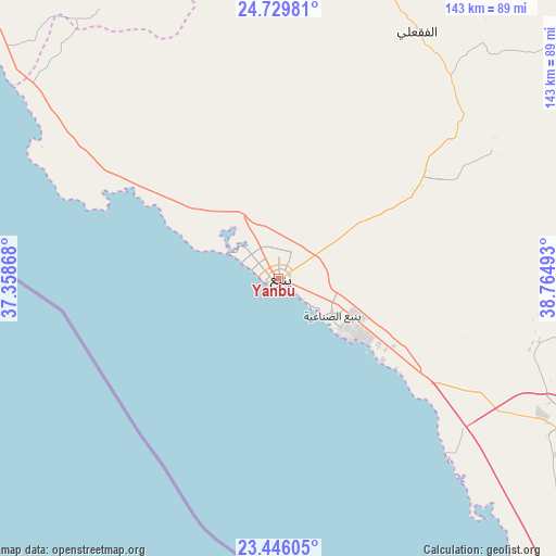
Yanbu GPS coordinates[2]
24° 5' 22.344" North, 38° 3' 42.48" East
| Map corner | latitude | longitude |
|---|---|---|
| Upper-left | 24.72981°, | 37.35868° |
| Center: | 24.08954°, | 38.0618° |
| Lower-right: | 23.44605°, | 38.76493° |
| Map W x H: | 142.7×142.7 km | = 88.7×88.7mi |
| max Lat: | 31.67252° ⇑67% North |
| Yanbu: | 24.08954° |
| min Lat: | ⇓33% South 16.57946° |
| min Long | Yanbu | max Long |
| 35.69014° | 38.0618° | 54.09599° |
| W 6.2%⇐ | ⇒93.8% E |
Elevation
Elevation of Yanbu is 6 m = 20 ft, and this is 515.4 m = 1691 ft below average elevation for this country.
| Max E: |
2385 m = 7825 ft | 93.8% |
| Avg. | 521.4 m = 1711 ft | |
| Yanbu | 6 m = 20 ft | |
Min E: |
3 m = 10 ft | 6.2% |
See also: Yanbu elevation on elevation.city.
Geographical zone
Yanbu is located in North temperate zone (between Tropic of Cancer and the Arctic Circle). Distance of this Northern Tropic circle is 72.6 km =45.1 mi to South.| Distance of | km | miles | from Yanbu |
|---|---|---|---|
| North Pole | 7328.6 | 4553.8 | to North |
| Arctic Circle | 4722.7 | 2934.5 | to North |
| Tropic Cancer | 72.6 | 45.1 | to South |
| Equator | 2678.5 | 1664.3 | to South |


Nearby cities:
13 places around Yanbu: (largest is in red/bold)
• Al Hadā
379 km =235.5 mi,  142°
142°
• Al Jumūm
322 km =200.1 mi,  148°
148°
• Al Wajh
289.3 km =179.8 mi,  325°
325°
• Al-`Ula
280.4 km =174.2 mi,  357°
357°
• Ash Shafā
407.3 km =253.1 mi, 145°
• Badr Ḩunayn
81.5 km =50.6 mi,  114°
114°
• Jeddah
306.2 km =190.3 mi,  157°
157°
• Mecca
346.9 km =215.6 mi, 148°
• Medina
162.9 km =101.2 mi,  75°
75°
• Rābigh
174.5 km =108.4 mi, 145°
• Sulţānah
160.8 km =99.9 mi,  73°
73°
• Ta’if
395.7 km =245.9 mi, 142°
• Umm Lajj
131 km =81.4 mi,  322°
322°
Sources, notices
• [Note1] Compared only with cities in Saudi Arabia existing in our database
• [Src1] Map data: © OpenStreetMap contributors (CC-BY-SA)
• [Src2] Other city data from geonames.org with taken over terms of usage.
• [Src3] Geographical zone / Annual Mean Temperature by Robert A. Rohde @ Wikipedia
