Badr Ḩunayn geodata
Badr Ḩunayn (Al Madīnah al Munawwarah) is a populated place; located in Saudi Arabia in Asia/Riyadh (GMT+3) time zone. With population of 27,257 people, there are 48 cities with bigger population in this country. Compared to other cities in Saudi Arabia, 70.1% of cities are located further ↑North; 90.7% of cities are located further →East and 69.1% of cities have higher elevation than Badr Ḩunayn. Note1


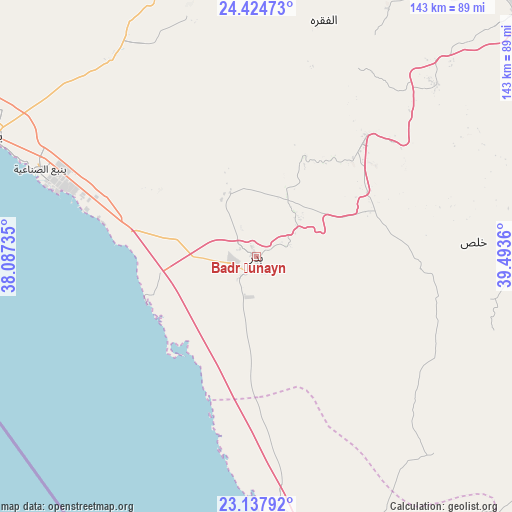
Badr Ḩunayn GPS coordinates[2]
23° 46' 58.512" North, 38° 47' 25.692" East
| Map corner | latitude | longitude |
|---|---|---|
| Upper-left | 24.42473°, | 38.08735° |
| Center: | 23.78292°, | 38.79047° |
| Lower-right: | 23.13792°, | 39.4936° |
| Map W x H: | 143.1×143.1 km | = 88.9×88.9mi |
| max Lat: | 31.67252° ⇑70.1% North |
| Badr Ḩunayn: | 23.78292° |
| min Lat: | ⇓29.9% South 16.57946° |
| min Long | Badr Ḩunayn | max Long |
| 35.69014° | 38.79047° | 54.09599° |
| W 9.3%⇐ | ⇒90.7% E |
Elevation
Elevation of Badr Ḩunayn is 116 m = 381 ft, and this is 405.4 m = 1330 ft below average elevation for this country.
| Max E: |
2385 m = 7825 ft | 69.1% |
| Avg. | 521.4 m = 1711 ft | |
| Badr Ḩunayn | 116 m = 381 ft | |
Min E: |
3 m = 10 ft | 30.9% |
See also: Saudi Arabia elevation on elevation.city.
Geographical zone
Badr Ḩunayn is located in North temperate zone (between Tropic of Cancer and the Arctic Circle). Distance of this Northern Tropic circle is 38.5 km =23.9 mi to South.| Distance of | km | miles | from Badr Ḩunayn |
|---|---|---|---|
| North Pole | 7362.6 | 4574.9 | to North |
| Arctic Circle | 4756.8 | 2955.7 | to North |
| Tropic Cancer | 38.5 | 23.9 | to South |
| Equator | 2644.4 | 1643.2 | to South |


Nearby cities:
15 places around Badr Ḩunayn: (largest is in red/bold)
• Al Hadā
309.4 km =192.3 mi,  150°
150°
• Al Jumūm
258.2 km =160.4 mi,  158°
158°
• Al Muwayh
338.6 km =210.4 mi,  116°
116°
• Al Wajh
361.2 km =224.4 mi,  319°
319°
• Al-`Ula
326.1 km =202.6 mi,  344°
344°
• Ash Shafā
339.6 km =211 mi, 152°
• Jeddah
252.6 km =157 mi,  170°
170°
• Mecca
282.7 km =175.7 mi, 157°
• Medina
113.1 km =70.3 mi,  47°
47°
• Rābigh
112.3 km =69.8 mi, 167°
• Sulţānah
112.9 km =70.2 mi, 45°
• Ta’if
325.4 km =202.2 mi, 149°
• Turabah
408.5 km =253.8 mi,  134°
134°
• Umm Lajj
206.7 km =128.4 mi,  311°
311°
• Yanbu
81.5 km =50.6 mi,  294°
294°
Sources, notices
• [Note1] Compared only with cities in Saudi Arabia existing in our database
• [Src1] Map data: © OpenStreetMap contributors (CC-BY-SA)
• [Src2] Other city data from geonames.org with taken over terms of usage.
• [Src3] Geographical zone / Annual Mean Temperature by Robert A. Rohde @ Wikipedia
