Ulricehamn geodata
Ulricehamn (Västra Götaland) is a seat of a second-order administrative division; located in Sweden in Europe/Stockholm (GMT+2) time zone. With population of 10,629 people, there are 142 cities with bigger population in this country. Compared to other cities in Sweden, 64.5% of cities are located further ↑North; 72.7% of cities are located further →East and 88.8% of cities have lower elevation than Ulricehamn. Note1


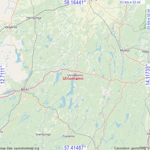
Ulricehamn GPS coordinates[2]
57° 47' 29.724" North, 13° 24' 51.192" East
| Map corner | latitude | longitude |
|---|---|---|
| Upper-left | 58.16441°, | 12.7111° |
| Center: | 57.79159°, | 13.41422° |
| Lower-right: | 57.41487°, | 14.11735° |
| Map W x H: | 83.3×83.3 km | = 51.8×51.8mi |
| max Lat: | 67.85572° ⇑64.5% North |
| Ulricehamn: | 57.79159° |
| min Lat: | ⇓35.5% South 55.34337° |
| min Long | Ulricehamn | max Long |
| 11.1712° | 13.41422° | 24.13676° |
| W 27.3%⇐ | ⇒72.7% E |
Elevation
Elevation of Ulricehamn is 189 m = 620 ft, and this is 106.4 m = 349 ft above average elevation for this country.
| Max E: |
663 m = 2175 ft | 11.2% |
| Ulricehamn | 189 m 620 ft | |
| Avg. | 82.6 m = 271 ft | |
Min E: |
-1 m = -3 ft | 88.8% |
See also: Sweden elevation on elevation.city.
Geographical zone
Ulricehamn is located in North temperate zone (between Tropic of Cancer and the Arctic Circle). Distance of this North polar circle is 975.4 km =606.1 mi to North.| Distance of | km | miles | from Ulricehamn |
|---|---|---|---|
| North Pole | 3581.2 | 2225.3 | to North |
| Arctic Circle | 975.4 | 606.1 | to North |
| Tropic Cancer | 3819.9 | 2373.6 | to South |
| Equator | 6425.8 | 3992.8 | to South |


Nearby cities:
15 places around Ulricehamn: (largest is in red/bold)
• Blidsberg
16.3 km =10.1 mi,  14°
14°
• Bottnaryd
24.5 km =15.2 mi,  95°
95°
• Dalsjöfors
21.3 km =13.2 mi,  247°
247°
• Dalstorp
21.8 km =13.5 mi,  162°
162°
• Dalum
12.3 km =7.6 mi, 14°
• Fristad
24.2 km =15 mi,  278°
278°
• Gällstad
13.9 km =8.6 mi,  175°
175°
• Gånghester
25.7 km =16 mi, 246°
• Hillared
23.6 km =14.7 mi,  221°
221°
• Hökerum
9.5 km =5.9 mi,  305°
305°
• Länghem
23.9 km =14.9 mi,  206°
206°
• Målsryd
24.7 km =15.3 mi,  240°
240°
• Sandhem
25.4 km =15.8 mi, 9°
• Timmele
7.6 km =4.7 mi, 6°
• Vegby
12.2 km =7.6 mi,  188°
188°
Sources, notices
• [Note1] Compared only with cities in Sweden existing in our database
• [Src1] Map data: © OpenStreetMap contributors (CC-BY-SA)
• [Src2] Other city data from geonames.org with taken over terms of usage.
• [Src3] Geographical zone / Annual Mean Temperature by Robert A. Rohde @ Wikipedia
