Fristad geodata
Fristad (Västra Götaland) is a populated place; located in Sweden in Europe/Stockholm (GMT+2) time zone. With population of 5,409 people, there are 253 cities with bigger population in this country. Compared to other cities in Sweden, 63.5% of cities are located further ↑North; 79.6% of cities are located further →East and 81.8% of cities have lower elevation than Fristad. Note1
Administrative division(s):
- Level 1: Västra Götaland
- Level 2: Borås
- Level 3: Fristad-Gingri
- Level 4: Fristad socken


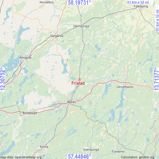
Fristad GPS coordinates[2]
57° 49' 29.388" North, 13° 0' 38.304" East
| Map corner | latitude | longitude |
|---|---|---|
| Upper-left | 58.19731°, | 12.30752° |
| Center: | 57.82483°, | 13.01064° |
| Lower-right: | 57.44846°, | 13.71377° |
| Map W x H: | 83.3×83.3 km | = 51.8×51.8mi |
| max Lat: | 67.85572° ⇑63.5% North |
| Fristad: | 57.82483° |
| min Lat: | ⇓36.5% South 55.34337° |
| min Long | Fristad | max Long |
| 11.1712° | 13.01064° | 24.13676° |
| W 20.4%⇐ | ⇒79.6% E |
Elevation
Elevation of Fristad is 152 m = 499 ft, and this is 69.4 m = 228 ft above average elevation for this country.
| Max E: |
663 m = 2175 ft | 18.2% |
| Fristad | 152 m 499 ft | |
| Avg. | 82.6 m = 271 ft | |
Min E: |
-1 m = -3 ft | 81.8% |
See also: Sweden elevation on elevation.city.
Geographical zone
Fristad is located in North temperate zone (between Tropic of Cancer and the Arctic Circle). Distance of this North polar circle is 971.7 km =603.8 mi to North.| Distance of | km | miles | from Fristad |
|---|---|---|---|
| North Pole | 3577.5 | 2223 | to North |
| Arctic Circle | 971.7 | 603.8 | to North |
| Tropic Cancer | 3823.6 | 2375.9 | to South |
| Equator | 6429.5 | 3995.1 | to South |


Nearby cities:
15 places around Fristad: (largest is in red/bold)
• Annelund
18.6 km =11.6 mi,  11°
11°
• Borås
12.3 km =7.6 mi,  199°
199°
• Dalsjöfors
12.8 km =8 mi,  160°
160°
• Frufällan
5.3 km =3.3 mi,  209°
209°
• Gånghester
13.9 km =8.6 mi,  178°
178°
• Hillared
22.8 km =14.2 mi, 158°
• Hökerum
16.3 km =10.1 mi,  83°
83°
• Ljung
18.2 km =11.3 mi, 8°
• Målsryd
15.9 km =9.9 mi,  171°
171°
• Olsfors
23.8 km =14.8 mi,  231°
231°
• Rydboholm
20.9 km =13 mi, 201°
• Sandared
18.2 km =11.3 mi, 225°
• Sandhult
13.2 km =8.2 mi,  240°
240°
• Sjömarken
16 km =9.9 mi,  220°
220°
• Viskafors
23.8 km =14.8 mi, 203°
Sources, notices
• [Note1] Compared only with cities in Sweden existing in our database
• [Src1] Map data: © OpenStreetMap contributors (CC-BY-SA)
• [Src2] Other city data from geonames.org with taken over terms of usage.
• [Src3] Geographical zone / Annual Mean Temperature by Robert A. Rohde @ Wikipedia
