Torsåker geodata
Torsåker (Gävleborg) is a populated place; located in Sweden in Europe/Stockholm (GMT+2) time zone. With population of 848 people, there are 930 cities with bigger population in this country. Compared to other cities in Sweden, 78.5% of cities are located further ↓South; 68.2% of cities are located further ←West and 59.2% of cities have lower elevation than Torsåker. Note1
Administrative division(s):
- Level 1: Gävleborg
- Level 2: Hofors Kommun
- Level 3: Hofors
- Level 4: Torsåker socken


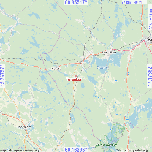
Torsåker GPS coordinates[2]
60° 30' 39.24" North, 16° 28' 14.484" East
| Map corner | latitude | longitude |
|---|---|---|
| Upper-left | 60.85517°, | 15.76757° |
| Center: | 60.5109°, | 16.47069° |
| Lower-right: | 60.16293°, | 17.17382° |
| Map W x H: | 77×77 km | = 47.8×47.8mi |
| max Lat: | 67.85572° ⇑21.5% North |
| Torsåker: | 60.5109° |
| min Lat: | ⇓78.5% South 55.34337° |
| min Long | Torsåker | max Long |
| 11.1712° | 16.47069° | 24.13676° |
| W 68.2%⇐ | ⇒31.8% E |
Elevation
Elevation of Torsåker is 68 m = 223 ft, and this is 14.6 m = 48 ft below average elevation for this country.
| Max E: |
663 m = 2175 ft | 40.8% |
| Avg. | 82.6 m = 271 ft | |
| Torsåker | 68 m = 223 ft | |
Min E: |
-1 m = -3 ft | 59.2% |
See also: Sweden elevation on elevation.city.
Geographical zone
Torsåker is located in North temperate zone (between Tropic of Cancer and the Arctic Circle). Distance of this North polar circle is 673 km =418.2 mi to North.| Distance of | km | miles | from Torsåker |
|---|---|---|---|
| North Pole | 3278.9 | 2037.4 | to North |
| Arctic Circle | 673 | 418.2 | to North |
| Tropic Cancer | 4122.3 | 2561.5 | to South |
| Equator | 6728.2 | 4180.7 | to South |


Nearby cities:
15 places around Torsåker: (largest is in red/bold)
• Forsbacka
25.4 km =15.8 mi,  62°
62°
• Garpenberg
26.2 km =16.3 mi,  214°
214°
• Hammarby
6.5 km =4 mi, 55°
• Hedesunda
31.5 km =19.6 mi,  113°
113°
• Hofors
10.8 km =6.7 mi,  291°
291°
• Horndal
23.6 km =14.7 mi,  187°
187°
• Järbo
23.9 km =14.9 mi,  17°
17°
• Kungsgården
12.7 km =7.9 mi,  38°
38°
• Långshyttan
24.6 km =15.3 mi,  254°
254°
• Sandviken
20 km =12.4 mi,  53°
53°
• Storvik
8.8 km =5.5 mi, 23°
• Valbo
34.4 km =21.4 mi, 63°
• Årsunda
14.4 km =8.9 mi,  87°
87°
• Åshammar
14.9 km =9.3 mi, 19°
• Överhärde
29.5 km =18.3 mi,  66°
66°
Sources, notices
• [Note1] Compared only with cities in Sweden existing in our database
• [Src1] Map data: © OpenStreetMap contributors (CC-BY-SA)
• [Src2] Other city data from geonames.org with taken over terms of usage.
• [Src3] Geographical zone / Annual Mean Temperature by Robert A. Rohde @ Wikipedia
