Hedesunda geodata
Hedesunda (Gävleborg) is a populated place; located in Sweden in Europe/Stockholm (GMT+2) time zone. With population of 1,067 people, there are 783 cities with bigger population in this country. Compared to other cities in Sweden, 77.5% of cities are located further ↓South; 73.5% of cities are located further ←West and 50.9% of cities have lower elevation than Hedesunda. Note1


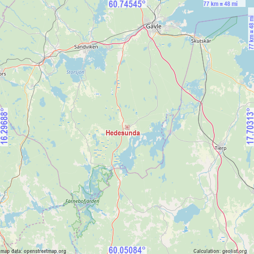
Hedesunda GPS coordinates[2]
60° 24' 0" North, 17° 0' 0" East
| Map corner | latitude | longitude |
|---|---|---|
| Upper-left | 60.74545°, | 16.29688° |
| Center: | 60.4°, | 17° |
| Lower-right: | 60.05084°, | 17.70313° |
| Map W x H: | 77.2×77.2 km | = 48×48mi |
| max Lat: | 67.85572° ⇑22.5% North |
| Hedesunda: | 60.4° |
| min Lat: | ⇓77.5% South 55.34337° |
| min Long | Hedesunda | max Long |
| 11.1712° | 17° | 24.13676° |
| W 73.5%⇐ | ⇒26.5% E |
Elevation
Elevation of Hedesunda is 52 m = 171 ft, and this is 30.6 m = 100 ft below average elevation for this country.
| Max E: |
663 m = 2175 ft | 49.1% |
| Avg. | 82.6 m = 271 ft | |
| Hedesunda | 52 m = 171 ft | |
Min E: |
-1 m = -3 ft | 50.9% |
See also: Sweden elevation on elevation.city.
Geographical zone
Hedesunda is located in North temperate zone (between Tropic of Cancer and the Arctic Circle). Distance of this North polar circle is 685.3 km =425.8 mi to North.| Distance of | km | miles | from Hedesunda |
|---|---|---|---|
| North Pole | 3291.2 | 2045.1 | to North |
| Arctic Circle | 685.3 | 425.8 | to North |
| Tropic Cancer | 4109.9 | 2553.8 | to South |
| Equator | 6715.9 | 4173.1 | to South |


Nearby cities:
15 places around Hedesunda: (largest is in red/bold)
• Forsbacka
24.9 km =15.5 mi,  345°
345°
• Gävle
31.5 km =19.6 mi,  14°
14°
• Hammarby
28.5 km =17.7 mi,  304°
304°
• Kungsgården
30.6 km =19 mi,  316°
316°
• Månkarbo
31.8 km =19.8 mi,  126°
126°
• Sandviken
27.3 km =17 mi,  332°
332°
• Söderfors
13 km =8.1 mi,  98°
98°
• Tierp
29.2 km =18.1 mi, 102°
• Torsåker
31.5 km =19.6 mi,  293°
293°
• Tärnsjö
28 km =17.4 mi,  187°
187°
• Valbo
27.9 km =17.3 mi,  3°
3°
• Älvkarleby
31.1 km =19.3 mi,  52°
52°
• Årsunda
19.5 km =12.1 mi,  311°
311°
• Östervåla
26.1 km =16.2 mi,  157°
157°
• Överhärde
24.2 km =15 mi,  355°
355°
Sources, notices
• [Note1] Compared only with cities in Sweden existing in our database
• [Src1] Map data: © OpenStreetMap contributors (CC-BY-SA)
• [Src2] Other city data from geonames.org with taken over terms of usage.
• [Src3] Geographical zone / Annual Mean Temperature by Robert A. Rohde @ Wikipedia
