Storvik geodata
Storvik (Gävleborg) is a populated place; located in Sweden in Europe/Stockholm (GMT+2) time zone. With population of 2,202 people, there are 493 cities with bigger population in this country. Compared to other cities in Sweden, 79.4% of cities are located further ↓South; 68.9% of cities are located further ←West and 50.7% of cities have higher elevation than Storvik. Note1


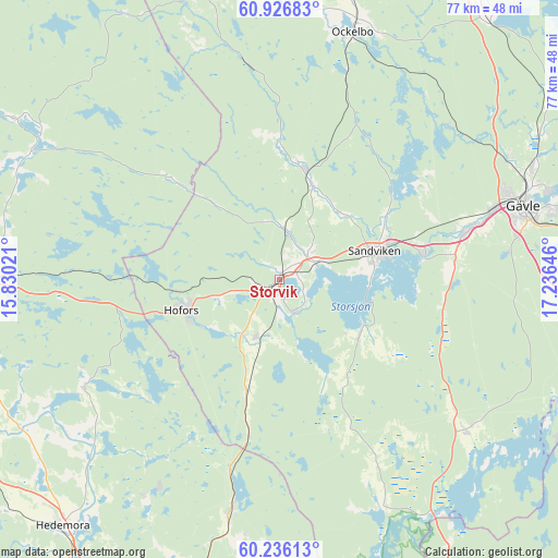
Storvik GPS coordinates[2]
60° 34' 59.988" North, 16° 31' 59.988" East
| Map corner | latitude | longitude |
|---|---|---|
| Upper-left | 60.92683°, | 15.83021° |
| Center: | 60.58333°, | 16.53333° |
| Lower-right: | 60.23613°, | 17.23646° |
| Map W x H: | 76.8×76.8 km | = 47.7×47.7mi |
| max Lat: | 67.85572° ⇑20.6% North |
| Storvik: | 60.58333° |
| min Lat: | ⇓79.4% South 55.34337° |
| min Long | Storvik | max Long |
| 11.1712° | 16.53333° | 24.13676° |
| W 68.9%⇐ | ⇒31.1% E |
Elevation
Elevation of Storvik is 49 m = 161 ft, and this is 33.6 m = 110 ft below average elevation for this country.
| Max E: |
663 m = 2175 ft | 50.7% |
| Avg. | 82.6 m = 271 ft | |
| Storvik | 49 m = 161 ft | |
Min E: |
-1 m = -3 ft | 49.3% |
See also: Sweden elevation on elevation.city.
Geographical zone
Storvik is located in North temperate zone (between Tropic of Cancer and the Arctic Circle). Distance of this North polar circle is 664.9 km =413.1 mi to North.| Distance of | km | miles | from Storvik |
|---|---|---|---|
| North Pole | 3270.8 | 2032.4 | to North |
| Arctic Circle | 664.9 | 413.1 | to North |
| Tropic Cancer | 4130.3 | 2566.4 | to South |
| Equator | 6736.2 | 4185.7 | to South |


Nearby cities:
15 places around Storvik: (largest is in red/bold)
• Forsbacka
19.5 km =12.1 mi,  79°
79°
• Gävle
34.7 km =21.6 mi,  73°
73°
• Hammarby
4.8 km =3 mi,  155°
155°
• Hedesunda
32.7 km =20.3 mi,  128°
128°
• Hofors
14.1 km =8.8 mi,  252°
252°
• Horndal
32.1 km =19.9 mi,  191°
191°
• Järbo
15.3 km =9.5 mi,  13°
13°
• Kungsgården
4.9 km =3 mi, 67°
• Långshyttan
30.8 km =19.1 mi,  241°
241°
• Sandviken
13.3 km =8.3 mi, 73°
• Torsåker
8.8 km =5.5 mi,  203°
203°
• Valbo
28.3 km =17.6 mi, 74°
• Årsunda
13.3 km =8.3 mi,  124°
124°
• Åshammar
6.2 km =3.9 mi, 13°
• Överhärde
23.9 km =14.9 mi, 81°
Sources, notices
• [Note1] Compared only with cities in Sweden existing in our database
• [Src1] Map data: © OpenStreetMap contributors (CC-BY-SA)
• [Src2] Other city data from geonames.org with taken over terms of usage.
• [Src3] Geographical zone / Annual Mean Temperature by Robert A. Rohde @ Wikipedia
