Strömsfors geodata
Strömsfors (Östergötland) is a populated place; located in Sweden in Europe/Stockholm (GMT+2) time zone. With population of 525 people, there are 1281 cities with bigger population in this country. Compared to other cities in Sweden, 50.2% of cities are located further ↓South; 65.8% of cities are located further ←West and 65.7% of cities have lower elevation than Strömsfors. Note1


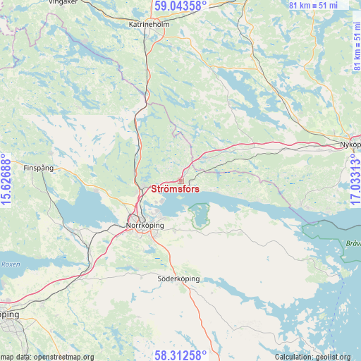
Strömsfors GPS coordinates[2]
58° 40' 48" North, 16° 19' 48" East
| Map corner | latitude | longitude |
|---|---|---|
| Upper-left | 59.04358°, | 15.62688° |
| Center: | 58.68°, | 16.33° |
| Lower-right: | 58.31258°, | 17.03313° |
| Map W x H: | 81.3×81.3 km | = 50.5×50.5mi |
| max Lat: | 67.85572° ⇑49.8% North |
| Strömsfors: | 58.68° |
| min Lat: | ⇓50.2% South 55.34337° |
| min Long | Strömsfors | max Long |
| 11.1712° | 16.33° | 24.13676° |
| W 65.8%⇐ | ⇒34.2% E |
Elevation
Elevation of Strömsfors is 85 m = 279 ft, and this is 2.4 m = 8 ft above average elevation for this country.
| Max E: |
663 m = 2175 ft | 34.3% |
| Strömsfors | 85 m 279 ft | |
| Avg. | 82.6 m = 271 ft | |
Min E: |
-1 m = -3 ft | 65.7% |
See also: Sweden elevation on elevation.city.
Geographical zone
Strömsfors is located in North temperate zone (between Tropic of Cancer and the Arctic Circle). Distance of this North polar circle is 876.6 km =544.7 mi to North.| Distance of | km | miles | from Strömsfors |
|---|---|---|---|
| North Pole | 3482.5 | 2163.9 | to North |
| Arctic Circle | 876.6 | 544.7 | to North |
| Tropic Cancer | 3918.7 | 2435 | to South |
| Equator | 6524.6 | 4054.2 | to South |


Nearby cities:
15 places around Strömsfors: (largest is in red/bold)
• Jursla
8.6 km =5.3 mi,  260°
260°
• Jönåker
23.6 km =14.7 mi,  72°
72°
• Kimstad
25.7 km =16 mi,  235°
235°
• Krokek
2.3 km =1.4 mi,  111°
111°
• Lindö
8.4 km =5.2 mi,  213°
213°
• Ljunga
18.2 km =11.3 mi,  176°
176°
• Norrköping
12.8 km =8 mi,  221°
221°
• Nävekvarn
27.7 km =17.2 mi,  100°
100°
• Olstorp
23.2 km =14.4 mi,  49°
49°
• Skärblacka
27.9 km =17.3 mi, 243°
• Svärtinge
17.7 km =11 mi, 260°
• Söderköping
22.2 km =13.8 mi, 181°
• Åby
8.6 km =5.3 mi, 260°
• Öbonäs
17.2 km =10.7 mi, 207°
• Östra Husby
16.7 km =10.4 mi,  130°
130°
Sources, notices
• [Note1] Compared only with cities in Sweden existing in our database
• [Src1] Map data: © OpenStreetMap contributors (CC-BY-SA)
• [Src2] Other city data from geonames.org with taken over terms of usage.
• [Src3] Geographical zone / Annual Mean Temperature by Robert A. Rohde @ Wikipedia
