Skärplinge geodata
Skärplinge (Uppsala) is a populated place; located in Sweden in Europe/Stockholm (GMT+2) time zone. With population of 720 people, there are 1041 cities with bigger population in this country. Compared to other cities in Sweden, 78% of cities are located further ↓South; 82.4% of cities are located further ←West and 89.6% of cities have higher elevation than Skärplinge. Note1


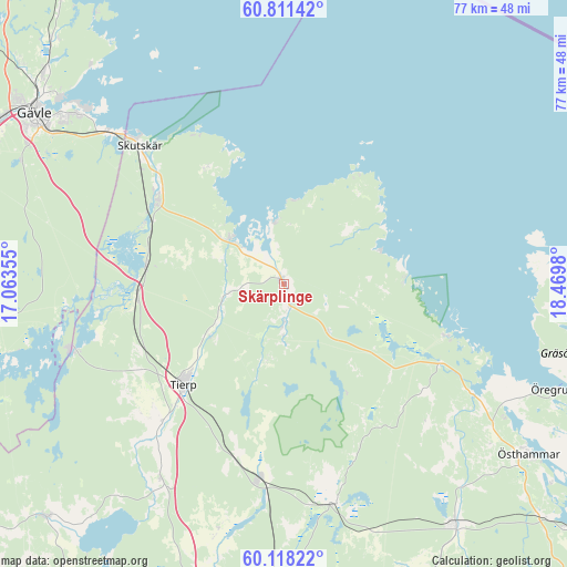
Skärplinge GPS coordinates[2]
60° 28' 0.012" North, 17° 46' 0.012" East
| Map corner | latitude | longitude |
|---|---|---|
| Upper-left | 60.81142°, | 17.06355° |
| Center: | 60.46667°, | 17.76667° |
| Lower-right: | 60.11822°, | 18.4698° |
| Map W x H: | 77.1×77.1 km | = 47.9×47.9mi |
| max Lat: | 67.85572° ⇑22% North |
| Skärplinge: | 60.46667° |
| min Lat: | ⇓78% South 55.34337° |
| min Long | Skärplinge | max Long |
| 11.1712° | 17.76667° | 24.13676° |
| W 82.4%⇐ | ⇒17.6% E |
Elevation
Elevation of Skärplinge is 9 m = 30 ft, and this is 73.6 m = 241 ft below average elevation for this country.
| Max E: |
663 m = 2175 ft | 89.6% |
| Avg. | 82.6 m = 271 ft | |
| Skärplinge | 9 m = 30 ft | |
Min E: |
-1 m = -3 ft | 10.4% |
See also: Sweden elevation on elevation.city.
Geographical zone
Skärplinge is located in North temperate zone (between Tropic of Cancer and the Arctic Circle). Distance of this North polar circle is 677.9 km =421.2 mi to North.| Distance of | km | miles | from Skärplinge |
|---|---|---|---|
| North Pole | 3283.8 | 2040.5 | to North |
| Arctic Circle | 677.9 | 421.2 | to North |
| Tropic Cancer | 4117.3 | 2558.4 | to South |
| Equator | 6723.3 | 4177.7 | to South |


Nearby cities:
15 places around Skärplinge: (largest is in red/bold)
• Bönan
39.2 km =24.4 mi,  320°
320°
• Furuvik
31.2 km =19.4 mi,  310°
310°
• Gimo
40 km =24.9 mi,  144°
144°
• Karby
36.6 km =22.7 mi,  196°
196°
• Karlholmsbruk
9.5 km =5.9 mi, 309°
• Månkarbo
31.4 km =19.5 mi,  212°
212°
• Skutskär
26.1 km =16.2 mi, 312°
• Söderfors
30.7 km =19.1 mi,  252°
252°
• Tierp
19.4 km =12.1 mi,  224°
224°
• Tobo
23.9 km =14.9 mi,  194°
194°
• Älvkarleby
20.9 km =13 mi,  303°
303°
• Örbyhus
27.2 km =16.9 mi, 187°
• Öregrund
39.5 km =24.5 mi,  112°
112°
• Österbybruk
30.5 km =19 mi,  166°
166°
• Östhammar
40.6 km =25.2 mi,  124°
124°
Sources, notices
• [Note1] Compared only with cities in Sweden existing in our database
• [Src1] Map data: © OpenStreetMap contributors (CC-BY-SA)
• [Src2] Other city data from geonames.org with taken over terms of usage.
• [Src3] Geographical zone / Annual Mean Temperature by Robert A. Rohde @ Wikipedia
