Tierp geodata
Tierp (Uppsala) is a seat of a second-order administrative division; located in Sweden in Europe/Stockholm (GMT+2) time zone. With population of 5,826 people, there are 245 cities with bigger population in this country. Compared to other cities in Sweden, 77.2% of cities are located further ↓South; 79.5% of cities are located further ←West and 76.2% of cities have higher elevation than Tierp. Note1


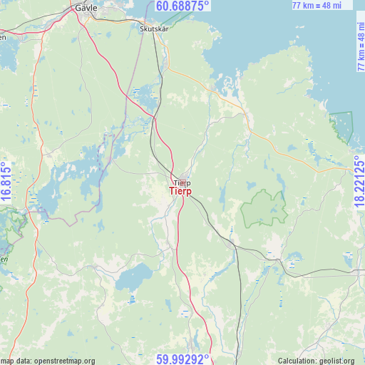
Tierp GPS coordinates[2]
60° 20' 33.684" North, 17° 31' 5.232" East
| Map corner | latitude | longitude |
|---|---|---|
| Upper-left | 60.68875°, | 16.815° |
| Center: | 60.34269°, | 17.51812° |
| Lower-right: | 59.99292°, | 18.22125° |
| Map W x H: | 77.4×77.4 km | = 48.1×48.1mi |
| max Lat: | 67.85572° ⇑22.8% North |
| Tierp: | 60.34269° |
| min Lat: | ⇓77.2% South 55.34337° |
| min Long | Tierp | max Long |
| 11.1712° | 17.51812° | 24.13676° |
| W 79.5%⇐ | ⇒20.5% E |
Elevation
Elevation of Tierp is 19 m = 62 ft, and this is 63.6 m = 209 ft below average elevation for this country.
| Max E: |
663 m = 2175 ft | 76.2% |
| Avg. | 82.6 m = 271 ft | |
| Tierp | 19 m = 62 ft | |
Min E: |
-1 m = -3 ft | 23.8% |
See also: Sweden elevation on elevation.city.
Geographical zone
Tierp is located in North temperate zone (between Tropic of Cancer and the Arctic Circle). Distance of this North polar circle is 691.7 km =429.8 mi to North.| Distance of | km | miles | from Tierp |
|---|---|---|---|
| North Pole | 3297.6 | 2049 | to North |
| Arctic Circle | 691.7 | 429.8 | to North |
| Tropic Cancer | 4103.6 | 2549.9 | to South |
| Equator | 6709.5 | 4169.1 | to South |


Nearby cities:
15 places around Tierp: (largest is in red/bold)
• Harbo
32.2 km =20 mi,  213°
213°
• Hedesunda
29.2 km =18.1 mi,  282°
282°
• Karby
21.7 km =13.5 mi,  170°
170°
• Karlholmsbruk
20.8 km =12.9 mi,  17°
17°
• Månkarbo
13.1 km =8.1 mi,  193°
193°
• Skutskär
31.9 km =19.8 mi,  349°
349°
• Skyttorp
31.2 km =19.4 mi,  157°
157°
• Skärplinge
19.4 km =12.1 mi,  44°
44°
• Söderfors
16.3 km =10.1 mi,  286°
286°
• Tobo
12.1 km =7.5 mi,  140°
140°
• Viby
32.2 km =20 mi, 213°
• Älvkarleby
25.6 km =15.9 mi, 351°
• Örbyhus
16.6 km =10.3 mi, 142°
• Österbybruk
26.4 km =16.4 mi,  126°
126°
• Östervåla
25.6 km =15.9 mi,  226°
226°
Sources, notices
• [Note1] Compared only with cities in Sweden existing in our database
• [Src1] Map data: © OpenStreetMap contributors (CC-BY-SA)
• [Src2] Other city data from geonames.org with taken over terms of usage.
• [Src3] Geographical zone / Annual Mean Temperature by Robert A. Rohde @ Wikipedia
