Örbyhus geodata
Örbyhus (Uppsala) is a populated place; located in Sweden in Europe/Stockholm (GMT+2) time zone. With population of 2,025 people, there are 518 cities with bigger population in this country. Compared to other cities in Sweden, 76.1% of cities are located further ↓South; 81.5% of cities are located further ←West and 71.8% of cities have higher elevation than Örbyhus. Note1
Administrative division(s):
- Level 1: Uppsala
- Level 2: Tierps kommun
- Level 3: Vendel
- Level 4: Vendel socken


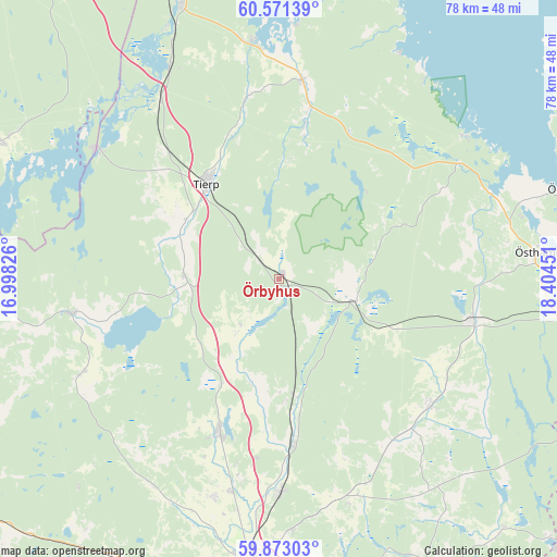
Örbyhus GPS coordinates[2]
60° 13' 26.652" North, 17° 42' 4.968" East
| Map corner | latitude | longitude |
|---|---|---|
| Upper-left | 60.57139°, | 16.99826° |
| Center: | 60.22407°, | 17.70138° |
| Lower-right: | 59.87303°, | 18.40451° |
| Map W x H: | 77.7×77.6 km | = 48.3×48.2mi |
| max Lat: | 67.85572° ⇑23.9% North |
| Örbyhus: | 60.22407° |
| min Lat: | ⇓76.1% South 55.34337° |
| min Long | Örbyhus | max Long |
| 11.1712° | 17.70138° | 24.13676° |
| W 81.5%⇐ | ⇒18.5% E |
Elevation
Elevation of Örbyhus is 23 m = 75 ft, and this is 59.6 m = 196 ft below average elevation for this country.
| Max E: |
663 m = 2175 ft | 71.8% |
| Avg. | 82.6 m = 271 ft | |
| Örbyhus | 23 m = 75 ft | |
Min E: |
-1 m = -3 ft | 28.2% |
See also: Sweden elevation on elevation.city.
Geographical zone
Örbyhus is located in North temperate zone (between Tropic of Cancer and the Arctic Circle). Distance of this North polar circle is 704.9 km =438 mi to North.| Distance of | km | miles | from Örbyhus |
|---|---|---|---|
| North Pole | 3310.8 | 2057.2 | to North |
| Arctic Circle | 704.9 | 438 | to North |
| Tropic Cancer | 4090.4 | 2541.7 | to South |
| Equator | 6696.3 | 4160.9 | to South |


Nearby cities:
15 places around Örbyhus: (largest is in red/bold)
• Alunda
27.4 km =17 mi,  129°
129°
• Björklinge
23.1 km =14.4 mi,  200°
200°
• Gimo
27.3 km =17 mi,  101°
101°
• Karby
10.5 km =6.5 mi,  218°
218°
• Lövstalöt
30.4 km =18.9 mi,  192°
192°
• Månkarbo
13.2 km =8.2 mi,  272°
272°
• Skyttorp
15.7 km =9.8 mi,  173°
173°
• Skärplinge
27.2 km =16.9 mi,  7°
7°
• Storvreta
29.4 km =18.3 mi,  179°
179°
• Tierp
16.6 km =10.3 mi,  322°
322°
• Tobo
4.6 km =2.9 mi,  326°
326°
• Vattholma
23.1 km =14.4 mi, 175°
• Viby
31 km =19.3 mi,  243°
243°
• Österbybruk
11.3 km =7 mi, 103°
• Östervåla
29 km =18 mi,  261°
261°
Sources, notices
• [Note1] Compared only with cities in Sweden existing in our database
• [Src1] Map data: © OpenStreetMap contributors (CC-BY-SA)
• [Src2] Other city data from geonames.org with taken over terms of usage.
• [Src3] Geographical zone / Annual Mean Temperature by Robert A. Rohde @ Wikipedia
