Östra Husby geodata
Östra Husby (Östergötland) is a populated place; located in Sweden in Europe/Stockholm (GMT+2) time zone. With population of 868 people, there are 912 cities with bigger population in this country. Compared to other cities in Sweden, 51.1% of cities are located further ↑North; 69.1% of cities are located further ←West and 80.9% of cities have higher elevation than Östra Husby. Note1


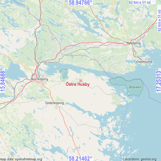
Östra Husby GPS coordinates[2]
58° 34' 59.016" North, 16° 33' 0" East
| Map corner | latitude | longitude |
|---|---|---|
| Upper-left | 58.94766°, | 15.84688° |
| Center: | 58.58306°, | 16.55° |
| Lower-right: | 58.21462°, | 17.25313° |
| Map W x H: | 81.5×81.5 km | = 50.6×50.6mi |
| max Lat: | 67.85572° ⇑51.1% North |
| Östra Husby: | 58.58306° |
| min Lat: | ⇓48.9% South 55.34337° |
| min Long | Östra Husby | max Long |
| 11.1712° | 16.55° | 24.13676° |
| W 69.1%⇐ | ⇒30.9% E |
Elevation
Elevation of Östra Husby is 15 m = 49 ft, and this is 67.6 m = 222 ft below average elevation for this country.
| Max E: |
663 m = 2175 ft | 80.9% |
| Avg. | 82.6 m = 271 ft | |
| Östra Husby | 15 m = 49 ft | |
Min E: |
-1 m = -3 ft | 19.1% |
See also: Sweden elevation on elevation.city.
Geographical zone
Östra Husby is located in North temperate zone (between Tropic of Cancer and the Arctic Circle). Distance of this North polar circle is 887.3 km =551.3 mi to North.| Distance of | km | miles | from Östra Husby |
|---|---|---|---|
| North Pole | 3493.2 | 2170.6 | to North |
| Arctic Circle | 887.3 | 551.3 | to North |
| Tropic Cancer | 3907.9 | 2428.3 | to South |
| Equator | 6513.8 | 4047.5 | to South |


Nearby cities:
15 places around Östra Husby: (largest is in red/bold)
• Bergshammar
27.3 km =17 mi,  50°
50°
• Jursla
23.2 km =14.4 mi,  293°
293°
• Jönåker
20.4 km =12.7 mi,  28°
28°
• Krokek
14.5 km =9 mi,  313°
313°
• Lindö
17.8 km =11.1 mi,  282°
282°
• Ljunga
13.8 km =8.6 mi,  237°
237°
• Norrköping
21.3 km =13.2 mi,  273°
273°
• Nävekvarn
15.5 km =9.6 mi,  68°
68°
• Olstorp
26.4 km =16.4 mi,  10°
10°
• Stigtomta
27.6 km =17.1 mi, 29°
• Strömsfors
16.7 km =10.4 mi, 310°
• Svalsta
25.6 km =15.9 mi, 46°
• Söderköping
17.5 km =10.9 mi,  229°
229°
• Åby
23.2 km =14.4 mi, 293°
• Öbonäs
21.3 km =13.2 mi,  258°
258°
Sources, notices
• [Note1] Compared only with cities in Sweden existing in our database
• [Src1] Map data: © OpenStreetMap contributors (CC-BY-SA)
• [Src2] Other city data from geonames.org with taken over terms of usage.
• [Src3] Geographical zone / Annual Mean Temperature by Robert A. Rohde @ Wikipedia
