Östervåla geodata
Östervåla (Uppsala) is a populated place; located in Sweden in Europe/Stockholm (GMT+2) time zone. With population of 1,696 people, there are 597 cities with bigger population in this country. Compared to other cities in Sweden, 75.7% of cities are located further ↓South; 76.3% of cities are located further ←West and 61.1% of cities have higher elevation than Östervåla. Note1


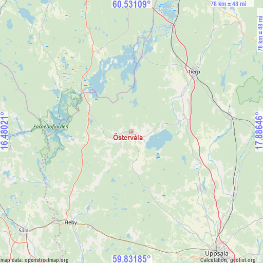
Östervåla GPS coordinates[2]
60° 10' 59.988" North, 17° 10' 59.988" East
| Map corner | latitude | longitude |
|---|---|---|
| Upper-left | 60.53109°, | 16.48021° |
| Center: | 60.18333°, | 17.18333° |
| Lower-right: | 59.83185°, | 17.88646° |
| Map W x H: | 77.7×77.7 km | = 48.3×48.3mi |
| max Lat: | 67.85572° ⇑24.3% North |
| Östervåla: | 60.18333° |
| min Lat: | ⇓75.7% South 55.34337° |
| min Long | Östervåla | max Long |
| 11.1712° | 17.18333° | 24.13676° |
| W 76.3%⇐ | ⇒23.7% E |
Elevation
Elevation of Östervåla is 34 m = 112 ft, and this is 48.6 m = 159 ft below average elevation for this country.
| Max E: |
663 m = 2175 ft | 61.1% |
| Avg. | 82.6 m = 271 ft | |
| Östervåla | 34 m = 112 ft | |
Min E: |
-1 m = -3 ft | 38.9% |
See also: Sweden elevation on elevation.city.
Geographical zone
Östervåla is located in North temperate zone (between Tropic of Cancer and the Arctic Circle). Distance of this North polar circle is 709.4 km =440.8 mi to North.| Distance of | km | miles | from Östervåla |
|---|---|---|---|
| North Pole | 3315.3 | 2060 | to North |
| Arctic Circle | 709.4 | 440.8 | to North |
| Tropic Cancer | 4085.8 | 2538.8 | to South |
| Equator | 6691.8 | 4158.1 | to South |


Nearby cities:
15 places around Östervåla: (largest is in red/bold)
• Björklinge
26.6 km =16.5 mi,  129°
129°
• Bälinge
32.4 km =20.1 mi,  143°
143°
• Harbo
9.3 km =5.8 mi,  174°
174°
• Hedesunda
26.1 km =16.2 mi,  337°
337°
• Karby
22.4 km =13.9 mi,  99°
99°
• Morgongåva
30.3 km =18.8 mi,  203°
203°
• Månkarbo
16.2 km =10.1 mi,  72°
72°
• Skyttorp
32.4 km =20.1 mi,  110°
110°
• Söderfors
22.4 km =13.9 mi,  7°
7°
• Tierp
25.6 km =15.9 mi,  46°
46°
• Tobo
27.4 km =17 mi, 72°
• Tärnsjö
14.3 km =8.9 mi,  254°
254°
• Viby
9.3 km =5.8 mi, 174°
• Vittinge
32.2 km =20 mi,  191°
191°
• Örbyhus
29 km =18 mi,  81°
81°
Sources, notices
• [Note1] Compared only with cities in Sweden existing in our database
• [Src1] Map data: © OpenStreetMap contributors (CC-BY-SA)
• [Src2] Other city data from geonames.org with taken over terms of usage.
• [Src3] Geographical zone / Annual Mean Temperature by Robert A. Rohde @ Wikipedia
