Färgelanda geodata
Färgelanda (Västra Götaland) is a seat of a second-order administrative division; located in Sweden in Europe/Stockholm (GMT+2) time zone. With population of 1,986 people, there are 521 cities with bigger population in this country. Compared to other cities in Sweden, 51.3% of cities are located further ↑North; 94.8% of cities are located further →East and 68.5% of cities have lower elevation than Färgelanda. Note1


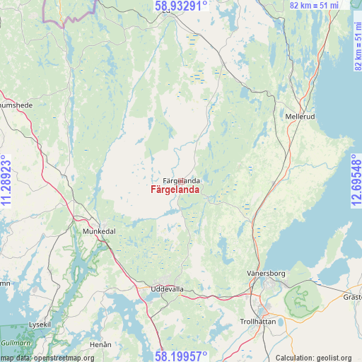
Färgelanda GPS coordinates[2]
58° 34' 5.376" North, 11° 59' 32.46" East
| Map corner | latitude | longitude |
|---|---|---|
| Upper-left | 58.93291°, | 11.28923° |
| Center: | 58.56816°, | 11.99235° |
| Lower-right: | 58.19957°, | 12.69548° |
| Map W x H: | 81.5×81.5 km | = 50.6×50.6mi |
| max Lat: | 67.85572° ⇑51.3% North |
| Färgelanda: | 58.56816° |
| min Lat: | ⇓48.7% South 55.34337° |
| min Long | Färgelanda | max Long |
| 11.1712° | 11.99235° | 24.13676° |
| W 5.2%⇐ | ⇒94.8% E |
Elevation
Elevation of Färgelanda is 94 m = 308 ft, and this is 11.4 m = 37 ft above average elevation for this country.
| Max E: |
663 m = 2175 ft | 31.5% |
| Färgelanda | 94 m 308 ft | |
| Avg. | 82.6 m = 271 ft | |
Min E: |
-1 m = -3 ft | 68.5% |
See also: Sweden elevation on elevation.city.
Geographical zone
Färgelanda is located in North temperate zone (between Tropic of Cancer and the Arctic Circle). Distance of this North polar circle is 889 km =552.4 mi to North.| Distance of | km | miles | from Färgelanda |
|---|---|---|---|
| North Pole | 3494.9 | 2171.6 | to North |
| Arctic Circle | 889 | 552.4 | to North |
| Tropic Cancer | 3906.2 | 2427.2 | to South |
| Equator | 6512.2 | 4046.5 | to South |


Nearby cities:
15 places around Färgelanda: (largest is in red/bold)
• Ammenäs
29.9 km =18.6 mi,  198°
198°
• Brålanda
20.7 km =12.9 mi,  91°
91°
• Bäckefors
28.1 km =17.5 mi,  20°
20°
• Dals Rostock
26.5 km =16.5 mi,  51°
51°
• Dingle
24.5 km =15.2 mi,  259°
259°
• Frändefors
18.5 km =11.5 mi,  114°
114°
• Hällevadsholm
26.2 km =16.3 mi,  272°
272°
• Mellerud
30.4 km =18.9 mi,  61°
61°
• Munkedal
21.7 km =13.5 mi,  238°
238°
• Sunningen
27.7 km =17.2 mi, 199°
• Uddevalla
24.7 km =15.3 mi,  186°
186°
• Vargön
33.1 km =20.6 mi,  135°
135°
• Vänersborg
28.4 km =17.6 mi, 137°
• Ödeborg
2.8 km =1.7 mi, 201°
• Ödsmål
33.8 km =21 mi,  299°
299°
Sources, notices
• [Note1] Compared only with cities in Sweden existing in our database
• [Src1] Map data: © OpenStreetMap contributors (CC-BY-SA)
• [Src2] Other city data from geonames.org with taken over terms of usage.
• [Src3] Geographical zone / Annual Mean Temperature by Robert A. Rohde @ Wikipedia
