Ljungaverk geodata
Ljungaverk (Västernorrland) is a populated place; located in Sweden in Europe/Stockholm (GMT+2) time zone. With population of 917 people, there are 870 cities with bigger population in this country. Compared to other cities in Sweden, 87.4% of cities are located further ↓South; 62.5% of cities are located further ←West and 63.6% of cities have lower elevation than Ljungaverk. Note1
Administrative division(s):
- Level 1: Västernorrland
- Level 2: Ånge kommun
- Level 3: Torp
- Level 4: Torp socken


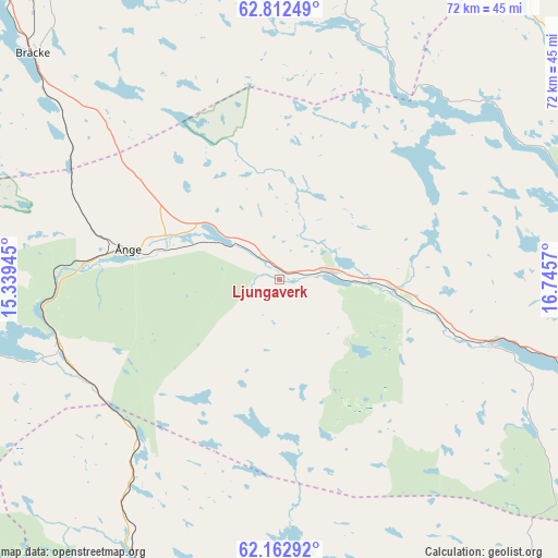
Ljungaverk GPS coordinates[2]
62° 29' 22.092" North, 16° 2' 33.252" East
| Map corner | latitude | longitude |
|---|---|---|
| Upper-left | 62.81249°, | 15.33945° |
| Center: | 62.48947°, | 16.04257° |
| Lower-right: | 62.16292°, | 16.7457° |
| Map W x H: | 72.2×72.2 km | = 44.9×44.9mi |
| max Lat: | 67.85572° ⇑12.6% North |
| Ljungaverk: | 62.48947° |
| min Lat: | ⇓87.4% South 55.34337° |
| min Long | Ljungaverk | max Long |
| 11.1712° | 16.04257° | 24.13676° |
| W 62.5%⇐ | ⇒37.5% E |
Elevation
Elevation of Ljungaverk is 79 m = 259 ft, and this is 3.6 m = 12 ft below average elevation for this country.
| Max E: |
663 m = 2175 ft | 36.4% |
| Avg. | 82.6 m = 271 ft | |
| Ljungaverk | 79 m = 259 ft | |
Min E: |
-1 m = -3 ft | 63.6% |
See also: Sweden elevation on elevation.city.
Geographical zone
Ljungaverk is located in North temperate zone (between Tropic of Cancer and the Arctic Circle). Distance of this North polar circle is 453 km =281.5 mi to North.| Distance of | km | miles | from Ljungaverk |
|---|---|---|---|
| North Pole | 3058.9 | 1900.7 | to North |
| Arctic Circle | 453 | 281.5 | to North |
| Tropic Cancer | 4342.3 | 2698.2 | to South |
| Equator | 6948.2 | 4317.4 | to South |


Nearby cities:
15 places around Ljungaverk: (largest is in red/bold)
• Bräcke
43 km =26.7 mi,  312°
312°
• Fanbyn
29.4 km =18.3 mi,  108°
108°
• Fränsta
6.6 km =4.1 mi,  81°
81°
• Gällö
62.6 km =38.9 mi,  318°
318°
• Högsjö
54 km =33.6 mi,  86°
86°
• Indal
55 km =34.2 mi, 79°
• Klingsta
63.2 km =39.3 mi, 106°
• Lucksta
56 km =34.8 mi, 112°
• Matfors
53.3 km =33.1 mi, 107°
• Stöde
29.1 km =18.1 mi, 105°
• Sundsvall
65.9 km =40.9 mi,  99°
99°
• Timrå
65.9 km =40.9 mi, 90°
• Vattjom
51.1 km =31.8 mi, 105°
• Vi
61.6 km =38.3 mi, 109°
• Ånge
20.1 km =12.5 mi,  281°
281°
Sources, notices
• [Note1] Compared only with cities in Sweden existing in our database
• [Src1] Map data: © OpenStreetMap contributors (CC-BY-SA)
• [Src2] Other city data from geonames.org with taken over terms of usage.
• [Src3] Geographical zone / Annual Mean Temperature by Robert A. Rohde @ Wikipedia
