Indal geodata
Indal (Västernorrland) is a populated place; located in Sweden in Europe/Stockholm (GMT+2) time zone. With population of 949 people, there are 849 cities with bigger population in this country. Compared to other cities in Sweden, 87.9% of cities are located further ↓South; 75.3% of cities are located further ←West and 68.5% of cities have lower elevation than Indal. Note1
Administrative division(s):
- Level 1: Västernorrland
- Level 2: Sundsvalls Kommun
- Level 3: Indal
- Level 4: Indal socken


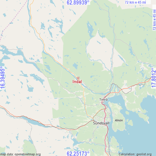
Indal GPS coordinates[2]
62° 34' 38.352" North, 17° 5' 53.052" East
| Map corner | latitude | longitude |
|---|---|---|
| Upper-left | 62.89939°, | 16.39495° |
| Center: | 62.57732°, | 17.09807° |
| Lower-right: | 62.25173°, | 17.8012° |
| Map W x H: | 72×72 km | = 44.7×44.7mi |
| max Lat: | 67.85572° ⇑12.1% North |
| Indal: | 62.57732° |
| min Lat: | ⇓87.9% South 55.34337° |
| min Long | Indal | max Long |
| 11.1712° | 17.09807° | 24.13676° |
| W 75.3%⇐ | ⇒24.7% E |
Elevation
Elevation of Indal is 94 m = 308 ft, and this is 11.4 m = 37 ft above average elevation for this country.
| Max E: |
663 m = 2175 ft | 31.5% |
| Indal | 94 m 308 ft | |
| Avg. | 82.6 m = 271 ft | |
Min E: |
-1 m = -3 ft | 68.5% |
See also: Sweden elevation on elevation.city.
Geographical zone
Indal is located in North temperate zone (between Tropic of Cancer and the Arctic Circle). Distance of this North polar circle is 443.2 km =275.4 mi to North.| Distance of | km | miles | from Indal |
|---|---|---|---|
| North Pole | 3049.1 | 1894.6 | to North |
| Arctic Circle | 443.2 | 275.4 | to North |
| Tropic Cancer | 4352 | 2704.2 | to South |
| Equator | 6957.9 | 4323.4 | to South |


Nearby cities:
15 places around Indal: (largest is in red/bold)
• Ankarsvik
28.1 km =17.5 mi,  145°
145°
• Bergeforsen
15.4 km =9.6 mi,  109°
109°
• Högsjö
6.2 km =3.9 mi,  183°
183°
• Johannedal
21.3 km =13.2 mi,  138°
138°
• Klingsta
28.5 km =17.7 mi,  167°
167°
• Lucksta
31 km =19.3 mi, 184°
• Matfors
25.7 km =16 mi,  187°
187°
• Stockvik
30.1 km =18.7 mi, 152°
• Sundsbruk
18.5 km =11.5 mi, 135°
• Sundsvall
23.3 km =14.5 mi, 152°
• Söråker
22.6 km =14 mi, 110°
• Timrå
15.4 km =9.6 mi,  130°
130°
• Vattjom
24 km =14.9 mi, 192°
• Vi
22.9 km =14.2 mi, 134°
• Vi
31 km =19.3 mi, 173°
Sources, notices
• [Note1] Compared only with cities in Sweden existing in our database
• [Src1] Map data: © OpenStreetMap contributors (CC-BY-SA)
• [Src2] Other city data from geonames.org with taken over terms of usage.
• [Src3] Geographical zone / Annual Mean Temperature by Robert A. Rohde @ Wikipedia
