Ånge geodata
Ånge (Västernorrland) is a seat of a second-order administrative division; located in Sweden in Europe/Stockholm (GMT+2) time zone. With population of 2,889 people, there are 414 cities with bigger population in this country. Compared to other cities in Sweden, 87.7% of cities are located further ↓South; 57.8% of cities are located further ←West and 85.1% of cities have lower elevation than Ånge. Note1
Administrative division(s):
- Level 1: Västernorrland
- Level 2: Ånge kommun
- Level 3: Borgsjö
- Level 4: Borgsjö socken


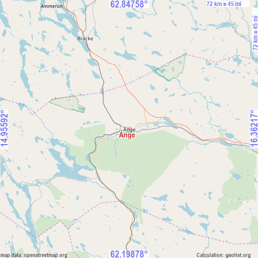
Ånge GPS coordinates[2]
62° 31' 29.82" North, 15° 39' 32.544" East
| Map corner | latitude | longitude |
|---|---|---|
| Upper-left | 62.84758°, | 14.95592° |
| Center: | 62.52495°, | 15.65904° |
| Lower-right: | 62.19878°, | 16.36217° |
| Map W x H: | 72.1×72.1 km | = 44.8×44.8mi |
| max Lat: | 67.85572° ⇑12.3% North |
| Ånge: | 62.52495° |
| min Lat: | ⇓87.7% South 55.34337° |
| min Long | Ånge | max Long |
| 11.1712° | 15.65904° | 24.13676° |
| W 57.8%⇐ | ⇒42.2% E |
Elevation
Elevation of Ånge is 168 m = 551 ft, and this is 85.4 m = 280 ft above average elevation for this country.
| Max E: |
663 m = 2175 ft | 14.9% |
| Ånge | 168 m 551 ft | |
| Avg. | 82.6 m = 271 ft | |
Min E: |
-1 m = -3 ft | 85.1% |
See also: Sweden elevation on elevation.city.
Geographical zone
Ånge is located in North temperate zone (between Tropic of Cancer and the Arctic Circle). Distance of this North polar circle is 449.1 km =279.1 mi to North.| Distance of | km | miles | from Ånge |
|---|---|---|---|
| North Pole | 3054.9 | 1898.2 | to North |
| Arctic Circle | 449.1 | 279.1 | to North |
| Tropic Cancer | 4346.2 | 2700.6 | to South |
| Equator | 6952.1 | 4319.8 | to South |


Nearby cities:
15 places around Ånge: (largest is in red/bold)
• Bräcke
27.9 km =17.3 mi,  334°
334°
• Fanbyn
49.4 km =30.7 mi,  105°
105°
• Fränsta
26.4 km =16.4 mi,  96°
96°
• Gällö
48.3 km =30 mi, 333°
• Hackås
72.7 km =45.2 mi,  306°
306°
• Hoverberg
69.7 km =43.3 mi,  297°
297°
• Hållsta
63.5 km =39.5 mi, 326°
• Högsjö
73.5 km =45.7 mi,  90°
90°
• Ljungaverk
20.1 km =12.5 mi, 101°
• Matfors
73.3 km =45.5 mi, 105°
• Stugun
71.4 km =44.4 mi,  357°
357°
• Stöde
49.1 km =30.5 mi, 103°
• Svenstavik
68 km =42.3 mi,  293°
293°
• Vattjom
71.2 km =44.2 mi, 104°
• Ytterhogdal
53.7 km =33.4 mi,  223°
223°
Sources, notices
• [Note1] Compared only with cities in Sweden existing in our database
• [Src1] Map data: © OpenStreetMap contributors (CC-BY-SA)
• [Src2] Other city data from geonames.org with taken over terms of usage.
• [Src3] Geographical zone / Annual Mean Temperature by Robert A. Rohde @ Wikipedia
