Jössefors geodata
Jössefors (Värmland) is a populated place; located in Sweden in Europe/Stockholm (GMT+2) time zone. With population of 711 people, there are 1053 cities with bigger population in this country. Compared to other cities in Sweden, 69.5% of cities are located further ↓South; 88.3% of cities are located further →East and 62.6% of cities have lower elevation than Jössefors. Note1


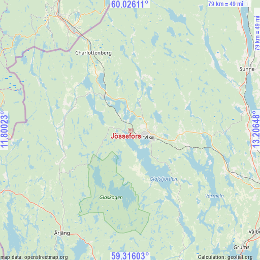
Jössefors GPS coordinates[2]
59° 40' 22.62" North, 12° 30' 12.06" East
| Map corner | latitude | longitude |
|---|---|---|
| Upper-left | 60.02611°, | 11.80023° |
| Center: | 59.67295°, | 12.50335° |
| Lower-right: | 59.31603°, | 13.20648° |
| Map W x H: | 79×79 km | = 49.1×49.1mi |
| max Lat: | 67.85572° ⇑30.5% North |
| Jössefors: | 59.67295° |
| min Lat: | ⇓69.5% South 55.34337° |
| min Long | Jössefors | max Long |
| 11.1712° | 12.50335° | 24.13676° |
| W 11.7%⇐ | ⇒88.3% E |
Elevation
Elevation of Jössefors is 76 m = 249 ft, and this is 6.6 m = 22 ft below average elevation for this country.
| Max E: |
663 m = 2175 ft | 37.4% |
| Avg. | 82.6 m = 271 ft | |
| Jössefors | 76 m = 249 ft | |
Min E: |
-1 m = -3 ft | 62.6% |
See also: Sweden elevation on elevation.city.
Geographical zone
Jössefors is located in North temperate zone (between Tropic of Cancer and the Arctic Circle). Distance of this North polar circle is 766.2 km =476.1 mi to North.| Distance of | km | miles | from Jössefors |
|---|---|---|---|
| North Pole | 3372.1 | 2095.3 | to North |
| Arctic Circle | 766.2 | 476.1 | to North |
| Tropic Cancer | 4029.1 | 2503.6 | to South |
| Equator | 6635 | 4122.8 | to South |


Nearby cities:
15 places around Jössefors: (largest is in red/bold)
• Arvika
5 km =3.1 mi,  113°
113°
• Charlottenberg
26 km =16.2 mi,  334°
334°
• Edane
18.7 km =11.6 mi, 105°
• Edsvalla
47.8 km =29.7 mi,  123°
123°
• Grums
49.5 km =30.8 mi,  136°
136°
• Gärsnäs
36.2 km =22.5 mi, 141°
• Högsäter
38.5 km =23.9 mi,  310°
310°
• Kil
49.4 km =30.7 mi, 112°
• Koppom
19.9 km =12.4 mi,  279°
279°
• Slottsbron
51.6 km =32.1 mi, 139°
• Sunne
40.2 km =25 mi,  62°
62°
• Töcksfors
41.4 km =25.7 mi,  243°
243°
• Vålberg
49.6 km =30.8 mi,  129°
129°
• Åmotfors
12.7 km =7.9 mi,  321°
321°
• Årjäng
37.5 km =23.3 mi,  213°
213°
Sources, notices
• [Note1] Compared only with cities in Sweden existing in our database
• [Src1] Map data: © OpenStreetMap contributors (CC-BY-SA)
• [Src2] Other city data from geonames.org with taken over terms of usage.
• [Src3] Geographical zone / Annual Mean Temperature by Robert A. Rohde @ Wikipedia
