Edane geodata
Edane (Värmland) is a populated place; located in Sweden in Europe/Stockholm (GMT+2) time zone. With population of 666 people, there are 1101 cities with bigger population in this country. Compared to other cities in Sweden, 69% of cities are located further ↓South; 83.9% of cities are located further →East and 58.9% of cities have lower elevation than Edane. Note1
Administrative division(s):
- Level 1: Värmland
- Level 2: Arvika Kommun
- Level 3: Brunskog
- Level 4: Brunskog socken


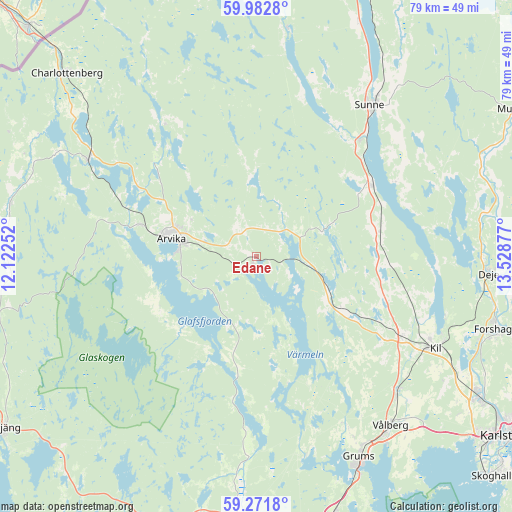
Edane GPS coordinates[2]
59° 37' 45.048" North, 12° 49' 32.304" East
| Map corner | latitude | longitude |
|---|---|---|
| Upper-left | 59.9828°, | 12.12252° |
| Center: | 59.62918°, | 12.82564° |
| Lower-right: | 59.2718°, | 13.52877° |
| Map W x H: | 79.1×79.1 km | = 49.2×49.2mi |
| max Lat: | 67.85572° ⇑31% North |
| Edane: | 59.62918° |
| min Lat: | ⇓69% South 55.34337° |
| min Long | Edane | max Long |
| 11.1712° | 12.82564° | 24.13676° |
| W 16.1%⇐ | ⇒83.9% E |
Elevation
Elevation of Edane is 67 m = 220 ft, and this is 15.6 m = 51 ft below average elevation for this country.
| Max E: |
663 m = 2175 ft | 41.1% |
| Avg. | 82.6 m = 271 ft | |
| Edane | 67 m = 220 ft | |
Min E: |
-1 m = -3 ft | 58.9% |
See also: Sweden elevation on elevation.city.
Geographical zone
Edane is located in North temperate zone (between Tropic of Cancer and the Arctic Circle). Distance of this North polar circle is 771 km =479.1 mi to North.| Distance of | km | miles | from Edane |
|---|---|---|---|
| North Pole | 3376.9 | 2098.3 | to North |
| Arctic Circle | 771 | 479.1 | to North |
| Tropic Cancer | 4024.2 | 2500.5 | to South |
| Equator | 6630.1 | 4119.8 | to South |


Nearby cities:
15 places around Edane: (largest is in red/bold)
• Arvika
13.8 km =8.6 mi,  282°
282°
• Charlottenberg
40.7 km =25.3 mi,  314°
314°
• Deje
36.5 km =22.7 mi,  94°
94°
• Edsvalla
30.6 km =19 mi,  135°
135°
• Forshaga
38.7 km =24 mi,  107°
107°
• Grums
34.8 km =21.6 mi,  152°
152°
• Gärsnäs
24 km =14.9 mi,  169°
169°
• Jössefors
18.7 km =11.6 mi,  285°
285°
• Kil
30.8 km =19.1 mi,  117°
117°
• Koppom
38.6 km =24 mi, 282°
• Skåre
40.6 km =25.2 mi, 122°
• Slottsbron
37.5 km =23.3 mi,  155°
155°
• Sunne
29.2 km =18.1 mi,  37°
37°
• Vålberg
33.4 km =20.8 mi, 142°
• Åmotfors
29.9 km =18.6 mi,  299°
299°
Sources, notices
• [Note1] Compared only with cities in Sweden existing in our database
• [Src1] Map data: © OpenStreetMap contributors (CC-BY-SA)
• [Src2] Other city data from geonames.org with taken over terms of usage.
• [Src3] Geographical zone / Annual Mean Temperature by Robert A. Rohde @ Wikipedia
