Hoting geodata
Hoting (Jämtland) is a populated place; located in Sweden in Europe/Stockholm (GMT+2) time zone. With population of 648 people, there are 1122 cities with bigger population in this country. Compared to other cities in Sweden, 93.4% of cities are located further ↓South; 64.2% of cities are located further ←West and 94.1% of cities have lower elevation than Hoting. Note1
Administrative division(s):
- Level 1: Jämtland
- Level 2: Strömsunds kommun
- Level 3: Tåsjö
- Level 4: Tåsjö socken


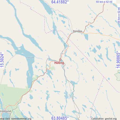
Hoting GPS coordinates[2]
64° 6' 48.708" North, 16° 12' 19.872" East
| Map corner | latitude | longitude |
|---|---|---|
| Upper-left | 64.41882°, | 15.5024° |
| Center: | 64.11353°, | 16.20552° |
| Lower-right: | 63.80485°, | 16.90865° |
| Map W x H: | 68.3×68.3 km | = 42.4×42.4mi |
| max Lat: | 67.85572° ⇑6.6% North |
| Hoting: | 64.11353° |
| min Lat: | ⇓93.4% South 55.34337° |
| min Long | Hoting | max Long |
| 11.1712° | 16.20552° | 24.13676° |
| W 64.2%⇐ | ⇒35.8% E |
Elevation
Elevation of Hoting is 243 m = 797 ft, and this is 160.4 m = 526 ft above average elevation for this country.
| Max E: |
663 m = 2175 ft | 5.9% |
| Hoting | 243 m 797 ft | |
| Avg. | 82.6 m = 271 ft | |
Min E: |
-1 m = -3 ft | 94.1% |
See also: Sweden elevation on elevation.city.
Geographical zone
Hoting is located in North temperate zone (between Tropic of Cancer and the Arctic Circle). Distance of this North polar circle is 272.4 km =169.3 mi to North.| Distance of | km | miles | from Hoting |
|---|---|---|---|
| North Pole | 2878.3 | 1788.5 | to North |
| Arctic Circle | 272.4 | 169.3 | to North |
| Tropic Cancer | 4522.8 | 2810.3 | to South |
| Equator | 7128.8 | 4429.6 | to South |


Nearby cities:
15 places around Hoting: (largest is in red/bold)
• Backe
34.3 km =21.3 mi,  163°
163°
• Dorotea
19.3 km =12 mi,  31°
31°
• Föllinge
92.3 km =57.4 mi,  237°
237°
• Hammerdal
72.6 km =45.1 mi,  214°
214°
• Insjön
69.4 km =43.1 mi,  62°
62°
• Junsele
57 km =35.4 mi,  144°
144°
• Lit
110.7 km =68.8 mi,  217°
217°
• Näsåker
82 km =51 mi, 155°
• Ramsele
65.1 km =40.5 mi,  168°
168°
• Strömsund
43 km =26.7 mi,  227°
227°
• Stugun
109.4 km =68 mi,  195°
195°
• Sörvik
23.8 km =14.8 mi,  275°
275°
• Vilhelmina
60.8 km =37.8 mi,  20°
20°
• Ås
85.1 km =52.9 mi, 167°
• Åsele
55.6 km =34.5 mi,  84°
84°
Sources, notices
• [Note1] Compared only with cities in Sweden existing in our database
• [Src1] Map data: © OpenStreetMap contributors (CC-BY-SA)
• [Src2] Other city data from geonames.org with taken over terms of usage.
• [Src3] Geographical zone / Annual Mean Temperature by Robert A. Rohde @ Wikipedia
