Åsele geodata
Åsele (Västerbotten) is a seat of a second-order administrative division; located in Sweden in Europe/Stockholm (GMT+2) time zone. With population of 1,706 people, there are 593 cities with bigger population in this country. Compared to other cities in Sweden, 93.5% of cities are located further ↓South; 77.8% of cities are located further ←West and 97% of cities have lower elevation than Åsele. Note1


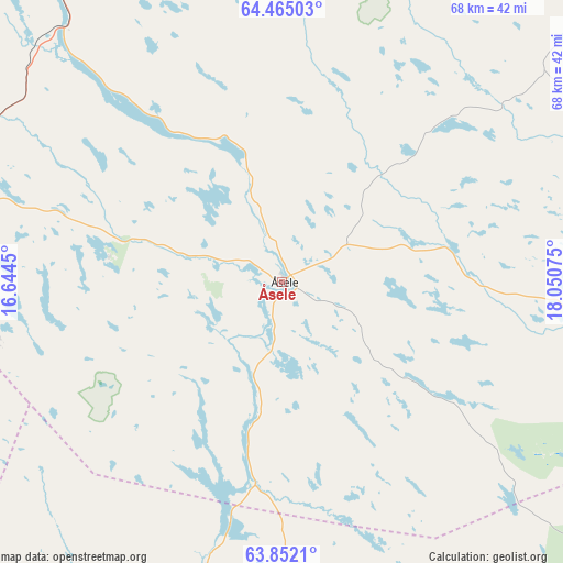
Åsele GPS coordinates[2]
64° 9' 36.936" North, 17° 20' 51.432" East
| Map corner | latitude | longitude |
|---|---|---|
| Upper-left | 64.46503°, | 16.6445° |
| Center: | 64.16026°, | 17.34762° |
| Lower-right: | 63.8521°, | 18.05075° |
| Map W x H: | 68.2×68.1 km | = 42.4×42.3mi |
| max Lat: | 67.85572° ⇑6.5% North |
| Åsele: | 64.16026° |
| min Lat: | ⇓93.5% South 55.34337° |
| min Long | Åsele | max Long |
| 11.1712° | 17.34762° | 24.13676° |
| W 77.8%⇐ | ⇒22.2% E |
Elevation
Elevation of Åsele is 320 m = 1050 ft, and this is 237.4 m = 779 ft above average elevation for this country.
| Max E: |
663 m = 2175 ft | 3% |
| Åsele | 320 m 1050 ft | |
| Avg. | 82.6 m = 271 ft | |
Min E: |
-1 m = -3 ft | 97% |
See also: Sweden elevation on elevation.city.
Geographical zone
Åsele is located in North temperate zone (between Tropic of Cancer and the Arctic Circle). Distance of this North polar circle is 267.2 km =166 mi to North.| Distance of | km | miles | from Åsele |
|---|---|---|---|
| North Pole | 2873.1 | 1785.3 | to North |
| Arctic Circle | 267.2 | 166 | to North |
| Tropic Cancer | 4528 | 2813.6 | to South |
| Equator | 7134 | 4432.9 | to South |


Nearby cities:
15 places around Åsele: (largest is in red/bold)
• Backe
60 km =37.3 mi,  230°
230°
• Bjurholm
94.3 km =58.6 mi,  105°
105°
• Bredbyn
87.7 km =54.5 mi,  154°
154°
• Dorotea
46.6 km =29 mi,  284°
284°
• Hoting
55.6 km =34.5 mi,  264°
264°
• Insjön
27.4 km =17 mi,  13°
13°
• Junsele
56.4 km =35 mi,  203°
203°
• Lycksele
80 km =49.7 mi,  52°
52°
• Näsåker
82.6 km =51.3 mi, 195°
• Ramsele
81.4 km =50.6 mi,  211°
211°
• Strömsund
93.8 km =58.3 mi,  248°
248°
• Söderfors
80.4 km =50 mi,  24°
24°
• Sörvik
79.1 km =49.2 mi,  267°
267°
• Tallåsen
73.5 km =45.7 mi,  77°
77°
• Vilhelmina
61.4 km =38.2 mi,  327°
327°
Sources, notices
• [Note1] Compared only with cities in Sweden existing in our database
• [Src1] Map data: © OpenStreetMap contributors (CC-BY-SA)
• [Src2] Other city data from geonames.org with taken over terms of usage.
• [Src3] Geographical zone / Annual Mean Temperature by Robert A. Rohde @ Wikipedia
