Grebbestad geodata
Grebbestad (Västra Götaland) is a populated place; located in Sweden in Europe/Stockholm (GMT+2) time zone. With population of 1,877 people, there are 551 cities with bigger population in this country. Compared to other cities in Sweden, 50.4% of cities are located further ↓South; 99.8% of cities are located further →East and 80.9% of cities have higher elevation than Grebbestad. Note1


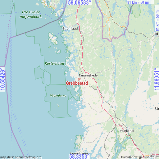
Grebbestad GPS coordinates[2]
58° 42' 8.928" North, 11° 15' 26.568" East
| Map corner | latitude | longitude |
|---|---|---|
| Upper-left | 59.06583°, | 10.55426° |
| Center: | 58.70248°, | 11.25738° |
| Lower-right: | 58.3353°, | 11.96051° |
| Map W x H: | 81.2×81.2 km | = 50.5×50.5mi |
| max Lat: | 67.85572° ⇑49.6% North |
| Grebbestad: | 58.70248° |
| min Lat: | ⇓50.4% South 55.34337° |
| min Long | Grebbestad | max Long |
| 11.1712° | 11.25738° | 24.13676° |
| W 0.2%⇐ | ⇒99.8% E |
Elevation
Elevation of Grebbestad is 15 m = 49 ft, and this is 67.6 m = 222 ft below average elevation for this country.
| Max E: |
663 m = 2175 ft | 80.9% |
| Avg. | 82.6 m = 271 ft | |
| Grebbestad | 15 m = 49 ft | |
Min E: |
-1 m = -3 ft | 19.1% |
See also: Sweden elevation on elevation.city.
Geographical zone
Grebbestad is located in North temperate zone (between Tropic of Cancer and the Arctic Circle). Distance of this North polar circle is 874.1 km =543.1 mi to North.| Distance of | km | miles | from Grebbestad |
|---|---|---|---|
| North Pole | 3480 | 2162.4 | to North |
| Arctic Circle | 874.1 | 543.1 | to North |
| Tropic Cancer | 3921.2 | 2436.5 | to South |
| Equator | 6527.1 | 4055.8 | to South |


Nearby cities:
15 places around Grebbestad: (largest is in red/bold)
• Brastad
37.8 km =23.5 mi,  159°
159°
• Dingle
26.9 km =16.7 mi,  136°
136°
• Fjällbacka
11.5 km =7.1 mi,  172°
172°
• Färgelanda
45.1 km =28 mi,  109°
109°
• Hamburgsund
16.7 km =10.4 mi,  176°
176°
• Hunnebostrand
29.2 km =18.1 mi, 174°
• Hällevadsholm
21.3 km =13.2 mi,  129°
129°
• Kungshamn
37.7 km =23.4 mi, 179°
• Munkedal
35.6 km =22.1 mi, 137°
• Skee
24.8 km =15.4 mi,  1°
1°
• Smögen
38.6 km =24 mi, 182°
• Strömstad
26.8 km =16.7 mi,  349°
349°
• Tanumshede
4.6 km =2.9 mi,  59°
59°
• Väjern
35.5 km =22.1 mi, 179°
• Ödsmål
13.1 km =8.1 mi,  83°
83°
Sources, notices
• [Note1] Compared only with cities in Sweden existing in our database
• [Src1] Map data: © OpenStreetMap contributors (CC-BY-SA)
• [Src2] Other city data from geonames.org with taken over terms of usage.
• [Src3] Geographical zone / Annual Mean Temperature by Robert A. Rohde @ Wikipedia
