Lilla Tjärby geodata
Lilla Tjärby (Halland) is a populated place; located in Sweden in Europe/Stockholm (GMT+2) time zone. With population of 872 people, there are 906 cities with bigger population in this country. Compared to other cities in Sweden, 83.6% of cities are located further ↑North; 78.5% of cities are located further →East and 54.7% of cities have higher elevation than Lilla Tjärby. Note1


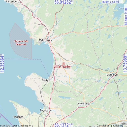
Lilla Tjärby GPS coordinates[2]
56° 31' 37.2" North, 13° 3' 24.336" East
| Map corner | latitude | longitude |
|---|---|---|
| Upper-left | 56.91282°, | 12.35364° |
| Center: | 56.527°, | 13.05676° |
| Lower-right: | 56.13721°, | 13.75989° |
| Map W x H: | 86.2×86.2 km | = 53.6×53.6mi |
| max Lat: | 67.85572° ⇑83.6% North |
| Lilla Tjärby: | 56.527° |
| min Lat: | ⇓16.4% South 55.34337° |
| min Long | Lilla Tjärby | max Long |
| 11.1712° | 13.05676° | 24.13676° |
| W 21.5%⇐ | ⇒78.5% E |
Elevation
Elevation of Lilla Tjärby is 43 m = 141 ft, and this is 39.6 m = 130 ft below average elevation for this country.
| Max E: |
663 m = 2175 ft | 54.7% |
| Avg. | 82.6 m = 271 ft | |
| Lilla Tjärby | 43 m = 141 ft | |
Min E: |
-1 m = -3 ft | 45.3% |
See also: Sweden elevation on elevation.city.
Geographical zone
Lilla Tjärby is located in North temperate zone (between Tropic of Cancer and the Arctic Circle). Distance of this North polar circle is 1116 km =693.5 mi to North.| Distance of | km | miles | from Lilla Tjärby |
|---|---|---|---|
| North Pole | 3721.8 | 2312.6 | to North |
| Arctic Circle | 1116 | 693.5 | to North |
| Tropic Cancer | 3679.3 | 2286.2 | to South |
| Equator | 6285.2 | 3905.4 | to South |


Nearby cities:
15 places around Lilla Tjärby: (largest is in red/bold)
• Båstad
16.7 km =10.4 mi,  228°
228°
• Eldsberga
8.8 km =5.5 mi,  336°
336°
• Fyllinge
16.1 km =10 mi,  327°
327°
• Genevad
4.9 km =3 mi, 341°
• Gullbranna
9.7 km =6 mi,  317°
317°
• Knäred
16.4 km =10.2 mi,  93°
93°
• Kyrkhult
13.1 km =8.1 mi,  78°
78°
• Laholm
1.8 km =1.1 mi,  205°
205°
• Mellbystrand
8.5 km =5.3 mi,  237°
237°
• Skottorp
10.5 km =6.5 mi, 214°
• Trönninge
12.5 km =7.8 mi, 322°
• Vallberga
7.1 km =4.4 mi,  200°
200°
• Veinge
2.6 km =1.6 mi,  13°
13°
• Våxtorp
12.9 km =8 mi,  162°
162°
• Östra Karup
13.5 km =8.4 mi, 213°
Sources, notices
• [Note1] Compared only with cities in Sweden existing in our database
• [Src1] Map data: © OpenStreetMap contributors (CC-BY-SA)
• [Src2] Other city data from geonames.org with taken over terms of usage.
• [Src3] Geographical zone / Annual Mean Temperature by Robert A. Rohde @ Wikipedia
