Skottorp geodata
Skottorp (Halland) is a populated place; located in Sweden in Europe/Stockholm (GMT+2) time zone. With population of 512 people, there are 1297 cities with bigger population in this country. Compared to other cities in Sweden, 84.6% of cities are located further ↑North; 81% of cities are located further →East and 82.7% of cities have higher elevation than Skottorp. Note1
Administrative division(s):
- Level 1: Halland
- Level 2: Laholms Kommun
- Level 3: Skummeslöv
- Level 4: Skummeslöv socken


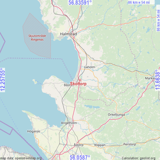
Skottorp GPS coordinates[2]
56° 26' 57.444" North, 12° 57' 38.412" East
| Map corner | latitude | longitude |
|---|---|---|
| Upper-left | 56.83591°, | 12.25755° |
| Center: | 56.44929°, | 12.96067° |
| Lower-right: | 56.0587°, | 13.6638° |
| Map W x H: | 86.4×86.4 km | = 53.7×53.7mi |
| max Lat: | 67.85572° ⇑84.6% North |
| Skottorp: | 56.44929° |
| min Lat: | ⇓15.4% South 55.34337° |
| min Long | Skottorp | max Long |
| 11.1712° | 12.96067° | 24.13676° |
| W 19%⇐ | ⇒81% E |
Elevation
Elevation of Skottorp is 14 m = 46 ft, and this is 68.6 m = 225 ft below average elevation for this country.
| Max E: |
663 m = 2175 ft | 82.7% |
| Avg. | 82.6 m = 271 ft | |
| Skottorp | 14 m = 46 ft | |
Min E: |
-1 m = -3 ft | 17.3% |
See also: Sweden elevation on elevation.city.
Geographical zone
Skottorp is located in North temperate zone (between Tropic of Cancer and the Arctic Circle). Distance of this North polar circle is 1124.6 km =698.8 mi to North.| Distance of | km | miles | from Skottorp |
|---|---|---|---|
| North Pole | 3730.5 | 2318 | to North |
| Arctic Circle | 1124.6 | 698.8 | to North |
| Tropic Cancer | 3670.7 | 2280.9 | to South |
| Equator | 6276.6 | 3900.1 | to South |


Nearby cities:
15 places around Skottorp: (largest is in red/bold)
• Båstad
7 km =4.3 mi,  249°
249°
• Förslöv
14.2 km =8.8 mi,  218°
218°
• Genevad
14 km =8.7 mi,  18°
18°
• Grevie
12.6 km =7.8 mi,  239°
239°
• Grevie
13.5 km =8.4 mi,  227°
227°
• Gullbranna
15.8 km =9.8 mi,  357°
357°
• Hjärnarp
15 km =9.3 mi,  190°
190°
• Laholm
8.6 km =5.3 mi,  36°
36°
• Lilla Tjärby
10.5 km =6.5 mi,  34°
34°
• Mellbystrand
4.2 km =2.6 mi,  342°
342°
• Vallberga
3.9 km =2.4 mi,  60°
60°
• Veinge
13 km =8.1 mi, 30°
• Västra Karup
13.4 km =8.3 mi, 254°
• Våxtorp
10.4 km =6.5 mi,  110°
110°
• Östra Karup
3 km =1.9 mi,  210°
210°
Sources, notices
• [Note1] Compared only with cities in Sweden existing in our database
• [Src1] Map data: © OpenStreetMap contributors (CC-BY-SA)
• [Src2] Other city data from geonames.org with taken over terms of usage.
• [Src3] Geographical zone / Annual Mean Temperature by Robert A. Rohde @ Wikipedia
