Ed geodata
Ed (Västra Götaland) is a seat of a second-order administrative division; located in Sweden in Europe/Stockholm (GMT+2) time zone. With population of 2,994 people, there are 404 cities with bigger population in this country. Compared to other cities in Sweden, 52.4% of cities are located further ↓South; 95.5% of cities are located further →East and 81.8% of cities have lower elevation than Ed. Note1
Administrative division(s):
- Level 1: Västra Götaland
- Level 2: Dals-Ed Kommun
- Level 3: Dals-Ed
- Level 4: Dals-Ed socken


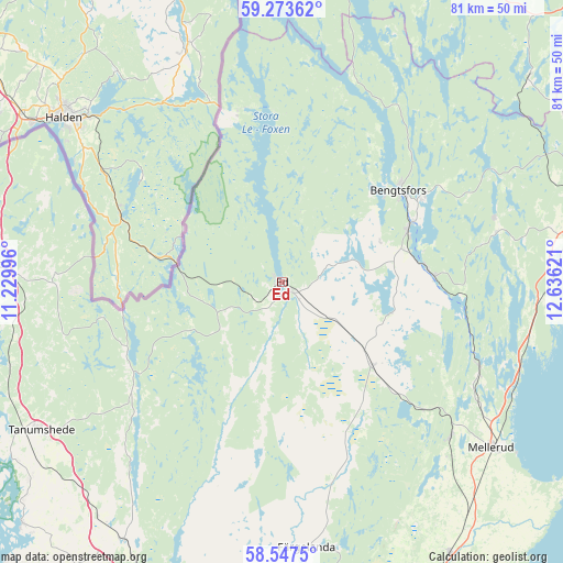
Ed GPS coordinates[2]
58° 54' 44.892" North, 11° 55' 59.088" East
| Map corner | latitude | longitude |
|---|---|---|
| Upper-left | 59.27362°, | 11.22996° |
| Center: | 58.91247°, | 11.93308° |
| Lower-right: | 58.5475°, | 12.63621° |
| Map W x H: | 80.7×80.7 km | = 50.1×50.1mi |
| max Lat: | 67.85572° ⇑47.6% North |
| Ed: | 58.91247° |
| min Lat: | ⇓52.4% South 55.34337° |
| min Long | Ed | max Long |
| 11.1712° | 11.93308° | 24.13676° |
| W 4.5%⇐ | ⇒95.5% E |
Elevation
Elevation of Ed is 152 m = 499 ft, and this is 69.4 m = 228 ft above average elevation for this country.
| Max E: |
663 m = 2175 ft | 18.2% |
| Ed | 152 m 499 ft | |
| Avg. | 82.6 m = 271 ft | |
Min E: |
-1 m = -3 ft | 81.8% |
See also: Sweden elevation on elevation.city.
Geographical zone
Ed is located in North temperate zone (between Tropic of Cancer and the Arctic Circle). Distance of this North polar circle is 850.7 km =528.6 mi to North.| Distance of | km | miles | from Ed |
|---|---|---|---|
| North Pole | 3456.6 | 2147.8 | to North |
| Arctic Circle | 850.7 | 528.6 | to North |
| Tropic Cancer | 3944.5 | 2451 | to South |
| Equator | 6550.5 | 4070.3 | to South |


Nearby cities:
15 places around Ed: (largest is in red/bold)
• Bengtsfors
21.5 km =13.4 mi,  52°
52°
• Billingsfors
19.8 km =12.3 mi,  66°
66°
• Bäckefors
17.8 km =11.1 mi,  132°
132°
• Dals Långed
21.6 km =13.4 mi,  86°
86°
• Dals Rostock
32.4 km =20.1 mi, 132°
• Fjällbacka
39.4 km =24.5 mi, 67°
• Färgelanda
38.4 km =23.9 mi,  174°
174°
• Hällevadsholm
43.4 km =27 mi,  211°
211°
• Mellerud
38.2 km =23.7 mi, 128°
• Skee
38.1 km =23.7 mi,  272°
272°
• Strömstad
43.8 km =27.2 mi, 273°
• Tanumshede
40.8 km =25.4 mi,  239°
239°
• Åsensbruk
30.8 km =19.1 mi,  114°
114°
• Ödeborg
40.9 km =25.4 mi,  176°
176°
• Ödsmål
33.8 km =21 mi,  229°
229°
Sources, notices
• [Note1] Compared only with cities in Sweden existing in our database
• [Src1] Map data: © OpenStreetMap contributors (CC-BY-SA)
• [Src2] Other city data from geonames.org with taken over terms of usage.
• [Src3] Geographical zone / Annual Mean Temperature by Robert A. Rohde @ Wikipedia
