Bjursås geodata
Bjursås (Dalarna) is a populated place; located in Sweden in Europe/Stockholm (GMT+2) time zone. With population of 1,968 people, there are 526 cities with bigger population in this country. Compared to other cities in Sweden, 81.3% of cities are located further ↓South; 54.9% of cities are located further ←West and 87.1% of cities have lower elevation than Bjursås. Note1
Administrative division(s):
- Level 1: Dalarna
- Level 2: Falu kommun
- Level 3: Bjursås
- Level 4: Bjursås socken


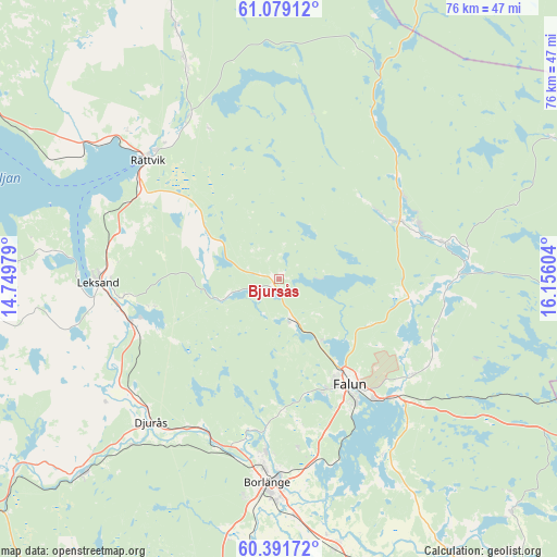
Bjursås GPS coordinates[2]
60° 44' 14.136" North, 15° 27' 10.476" East
| Map corner | latitude | longitude |
|---|---|---|
| Upper-left | 61.07912°, | 14.74979° |
| Center: | 60.73726°, | 15.45291° |
| Lower-right: | 60.39172°, | 16.15604° |
| Map W x H: | 76.4×76.4 km | = 47.5×47.5mi |
| max Lat: | 67.85572° ⇑18.7% North |
| Bjursås: | 60.73726° |
| min Lat: | ⇓81.3% South 55.34337° |
| min Long | Bjursås | max Long |
| 11.1712° | 15.45291° | 24.13676° |
| W 54.9%⇐ | ⇒45.1% E |
Elevation
Elevation of Bjursås is 177 m = 581 ft, and this is 94.4 m = 310 ft above average elevation for this country.
| Max E: |
663 m = 2175 ft | 12.9% |
| Bjursås | 177 m 581 ft | |
| Avg. | 82.6 m = 271 ft | |
Min E: |
-1 m = -3 ft | 87.1% |
See also: Sweden elevation on elevation.city.
Geographical zone
Bjursås is located in North temperate zone (between Tropic of Cancer and the Arctic Circle). Distance of this North polar circle is 647.8 km =402.5 mi to North.| Distance of | km | miles | from Bjursås |
|---|---|---|---|
| North Pole | 3253.7 | 2021.8 | to North |
| Arctic Circle | 647.8 | 402.5 | to North |
| Tropic Cancer | 4147.4 | 2577.1 | to South |
| Equator | 6753.4 | 4196.4 | to South |


Nearby cities:
15 places around Bjursås: (largest is in red/bold)
• Bengtsheden
23 km =14.3 mi,  97°
97°
• Djurmo
25.5 km =15.8 mi,  215°
215°
• Enviken
19.2 km =11.9 mi,  68°
68°
• Falun
17.6 km =10.9 mi,  147°
147°
• Gagnef
25.6 km =15.9 mi,  232°
232°
• Grycksbo
5.8 km =3.6 mi,  162°
162°
• Häradsbygden
23.2 km =14.4 mi,  259°
259°
• Insjön
20.6 km =12.8 mi,  250°
250°
• Leksand
24.6 km =15.3 mi,  268°
268°
• Linghed
22.2 km =13.8 mi,  76°
76°
• Rättvik
24.6 km =15.3 mi,  312°
312°
• Smedby
22.3 km =13.9 mi, 259°
• Sundborn
19.6 km =12.2 mi,  119°
119°
• Svärdsjö
24.4 km =15.2 mi,  89°
89°
• Sågmyra
9.5 km =5.9 mi, 256°
Sources, notices
• [Note1] Compared only with cities in Sweden existing in our database
• [Src1] Map data: © OpenStreetMap contributors (CC-BY-SA)
• [Src2] Other city data from geonames.org with taken over terms of usage.
• [Src3] Geographical zone / Annual Mean Temperature by Robert A. Rohde @ Wikipedia
