Båstad geodata
Båstad (Skåne) is a seat of a second-order administrative division; located in Sweden in Europe/Stockholm (GMT+2) time zone. With population of 5,146 people, there are 264 cities with bigger population in this country. Compared to other cities in Sweden, 84.6% of cities are located further ↑North; 83.3% of cities are located further →East and 82.7% of cities have higher elevation than Båstad. Note1


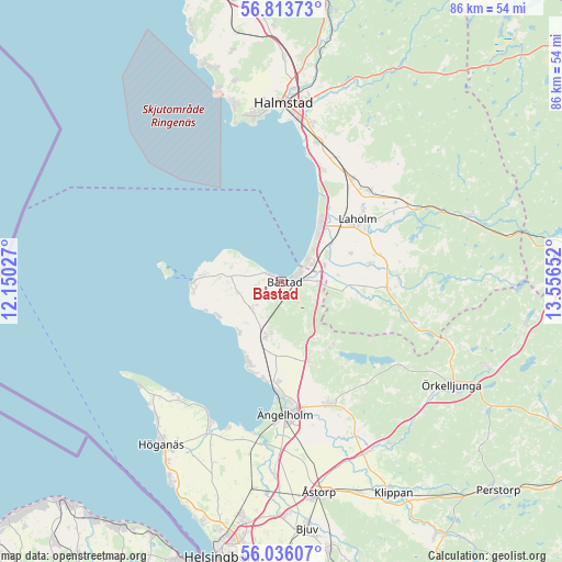
Båstad GPS coordinates[2]
56° 25' 36.804" North, 12° 51' 12.204" East
| Map corner | latitude | longitude |
|---|---|---|
| Upper-left | 56.81373°, | 12.15027° |
| Center: | 56.42689°, | 12.85339° |
| Lower-right: | 56.03607°, | 13.55652° |
| Map W x H: | 86.5×86.5 km | = 53.7×53.7mi |
| max Lat: | 67.85572° ⇑84.6% North |
| Båstad: | 56.42689° |
| min Lat: | ⇓15.4% South 55.34337° |
| min Long | Båstad | max Long |
| 11.1712° | 12.85339° | 24.13676° |
| W 16.7%⇐ | ⇒83.3% E |
Elevation
Elevation of Båstad is 14 m = 46 ft, and this is 68.6 m = 225 ft below average elevation for this country.
| Max E: |
663 m = 2175 ft | 82.7% |
| Avg. | 82.6 m = 271 ft | |
| Båstad | 14 m = 46 ft | |
Min E: |
-1 m = -3 ft | 17.3% |
See also: Sweden elevation on elevation.city.
Geographical zone
Båstad is located in North temperate zone (between Tropic of Cancer and the Arctic Circle). Distance of this North polar circle is 1127.1 km =700.3 mi to North.| Distance of | km | miles | from Båstad |
|---|---|---|---|
| North Pole | 3733 | 2319.6 | to North |
| Arctic Circle | 1127.1 | 700.3 | to North |
| Tropic Cancer | 3668.2 | 2279.3 | to South |
| Equator | 6274.1 | 3898.5 | to South |


Nearby cities:
15 places around Båstad: (largest is in red/bold)
• Förslöv
8.8 km =5.5 mi,  194°
194°
• Grevie
5.8 km =3.6 mi,  227°
227°
• Grevie
7.5 km =4.7 mi,  206°
206°
• Hjärnarp
12.9 km =8 mi,  162°
162°
• Laholm
15 km =9.3 mi,  50°
50°
• Lilla Tjärby
16.7 km =10.4 mi, 48°
• Mellbystrand
8.4 km =5.2 mi,  39°
39°
• Skepparkroken
15.4 km =9.6 mi, 192°
• Skottorp
7 km =4.3 mi,  69°
69°
• Torekov
13.5 km =8.4 mi,  269°
269°
• Vallberga
11 km =6.8 mi, 66°
• Vejbystrand
13.2 km =8.2 mi,  203°
203°
• Västra Karup
6.5 km =4 mi,  259°
259°
• Våxtorp
16.4 km =10.2 mi,  93°
93°
• Östra Karup
5.1 km =3.2 mi, 91°
Sources, notices
• [Note1] Compared only with cities in Sweden existing in our database
• [Src1] Map data: © OpenStreetMap contributors (CC-BY-SA)
• [Src2] Other city data from geonames.org with taken over terms of usage.
• [Src3] Geographical zone / Annual Mean Temperature by Robert A. Rohde @ Wikipedia
