Baggetorp geodata
Baggetorp (Örebro) is a populated place; located in Sweden in Europe/Stockholm (GMT+2) time zone. With population of 519 people, there are 1287 cities with bigger population in this country. Compared to other cities in Sweden, 55.9% of cities are located further ↓South; 55.2% of cities are located further →East and 77% of cities have lower elevation than Baggetorp. Note1


Baggetorp GPS coordinates[2]
59° 9' 0" North, 14° 37' 59.988" East
| Map corner | latitude | longitude |
|---|---|---|
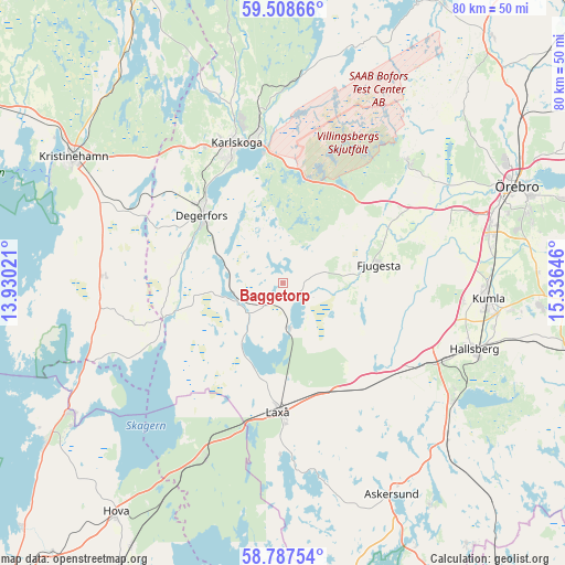
| Upper-left | 59.50866°, | 13.93021° |
| Center: | 59.15°, | 14.63333° |
| Lower-right: | 58.78754°, | 15.33646° |
| Map W x H: | 80.2×80.2 km | = 49.8×49.8mi |
| max Lat: | 67.85572° ⇑44.1% North |
| Baggetorp: | 59.15° |
| min Lat: | ⇓55.9% South 55.34337° |
| min Long | Baggetorp | max Long |
| 11.1712° | 14.63333° | 24.13676° |
| W 44.8%⇐ | ⇒55.2% E |
Elevation
Elevation of Baggetorp is 128 m = 420 ft, and this is 45.4 m = 149 ft above average elevation for this country.
| Max E: |
663 m = 2175 ft | 23% |
| Baggetorp | 128 m 420 ft | |
| Avg. | 82.6 m = 271 ft | |
Min E: |
-1 m = -3 ft | 77% |
See also: Sweden elevation on elevation.city.
Geographical zone
Baggetorp is located in North temperate zone (between Tropic of Cancer and the Arctic Circle). Distance of this North polar circle is 824.3 km =512.2 mi to North.| Distance of | km | miles | from Baggetorp |
|---|---|---|---|
| North Pole | 3430.2 | 2131.4 | to North |
| Arctic Circle | 824.3 | 512.2 | to North |
| Tropic Cancer | 3970.9 | 2467.4 | to South |
| Equator | 6576.9 | 4086.7 | to South |


Nearby cities:
15 places around Baggetorp: (largest is in red/bold)
• Björneborg
24.1 km =15 mi,  294°
294°
• Degerfors
15.1 km =9.4 mi,  310°
310°
• Finnerödja
26.7 km =16.6 mi,  205°
205°
• Fjugesta
13.9 km =8.6 mi,  79°
79°
• Garphyttan
24.7 km =15.3 mi,  46°
46°
• Hallsberg
28.8 km =17.9 mi,  109°
109°
• Karlskoga
20.6 km =12.8 mi,  342°
342°
• Latorpsbruk
24.1 km =15 mi,  55°
55°
• Laxå
18.2 km =11.3 mi,  182°
182°
• Mullhyttan
2.9 km =1.8 mi,  90°
90°
• Velanda
25.3 km =15.7 mi, 77°
• Vintrosa
21.2 km =13.2 mi, 58°
• Vretstorp
18.6 km =11.6 mi,  134°
134°
• Åbytorp
25.3 km =15.7 mi,  96°
96°
• Östansjö
22.9 km =14.2 mi,  119°
119°
Sources, notices
• [Note1] Compared only with cities in Sweden existing in our database
• [Src1] Map data: © OpenStreetMap contributors (CC-BY-SA)
• [Src2] Other city data from geonames.org with taken over terms of usage.
• [Src3] Geographical zone / Annual Mean Temperature by Robert A. Rohde @ Wikipedia
