Ytterhogdal geodata
Ytterhogdal (Jämtland) is a populated place; located in Sweden in Europe/Stockholm (GMT+2) time zone. With population of 534 people, there are 1264 cities with bigger population in this country. Compared to other cities in Sweden, 85.6% of cities are located further ↓South; 52.1% of cities are located further →East and 94.9% of cities have lower elevation than Ytterhogdal. Note1
Administrative division(s):
- Level 1: Jämtland
- Level 2: Härjedalens kommun
- Level 3: Ytterhogdal, Överhogdal och Ängersjö
- Level 4: Ytterhogdal socken


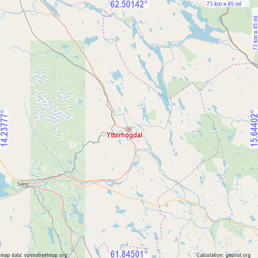
Ytterhogdal GPS coordinates[2]
62° 10' 30" North, 14° 56' 27.204" East
| Map corner | latitude | longitude |
|---|---|---|
| Upper-left | 62.50142°, | 14.23777° |
| Center: | 62.175°, | 14.94089° |
| Lower-right: | 61.84501°, | 15.64402° |
| Map W x H: | 73×73 km | = 45.4×45.4mi |
| max Lat: | 67.85572° ⇑14.4% North |
| Ytterhogdal: | 62.175° |
| min Lat: | ⇓85.6% South 55.34337° |
| min Long | Ytterhogdal | max Long |
| 11.1712° | 14.94089° | 24.13676° |
| W 47.9%⇐ | ⇒52.1% E |
Elevation
Elevation of Ytterhogdal is 262 m = 860 ft, and this is 179.4 m = 589 ft above average elevation for this country.
| Max E: |
663 m = 2175 ft | 5.1% |
| Ytterhogdal | 262 m 860 ft | |
| Avg. | 82.6 m = 271 ft | |
Min E: |
-1 m = -3 ft | 94.9% |
See also: Sweden elevation on elevation.city.
Geographical zone
Ytterhogdal is located in North temperate zone (between Tropic of Cancer and the Arctic Circle). Distance of this North polar circle is 488 km =303.2 mi to North.| Distance of | km | miles | from Ytterhogdal |
|---|---|---|---|
| North Pole | 3093.8 | 1922.4 | to North |
| Arctic Circle | 488 | 303.2 | to North |
| Tropic Cancer | 4307.3 | 2676.4 | to South |
| Equator | 6913.2 | 4295.7 | to South |


Nearby cities:
15 places around Ytterhogdal: (largest is in red/bold)
• Bräcke
68.6 km =42.6 mi,  21°
21°
• Fränsta
72.9 km =45.3 mi,  60°
60°
• Färila
63 km =39.1 mi,  131°
131°
• Gällö
83.4 km =51.8 mi,  10°
10°
• Hackås
85.3 km =53 mi,  345°
345°
• Hede
78.5 km =48.8 mi,  289°
289°
• Hoverberg
75.4 km =46.9 mi,  340°
340°
• Järvsö
81.9 km =50.9 mi, 128°
• Ljungaverk
66.8 km =41.5 mi, 58°
• Ljusdal
71.3 km =44.3 mi,  122°
122°
• Sveg
33.8 km =21 mi,  242°
242°
• Svenstavik
70.7 km =43.9 mi, 338°
• Tallåsen
65.8 km =40.9 mi, 121°
• Vemdalen
63.4 km =39.4 mi,  298°
298°
• Ånge
53.7 km =33.4 mi,  43°
43°
Sources, notices
• [Note1] Compared only with cities in Sweden existing in our database
• [Src1] Map data: © OpenStreetMap contributors (CC-BY-SA)
• [Src2] Other city data from geonames.org with taken over terms of usage.
• [Src3] Geographical zone / Annual Mean Temperature by Robert A. Rohde @ Wikipedia
