Övertorneå geodata
Övertorneå (Norrbotten) is a seat of a second-order administrative division; located in Sweden in Europe/Stockholm (GMT+2) time zone. With population of 1,906 people, there are 543 cities with bigger population in this country. Compared to other cities in Sweden, 99.2% of cities are located further ↓South; 99.8% of cities are located further ←West and 52.1% of cities have lower elevation than Övertorneå. Note1


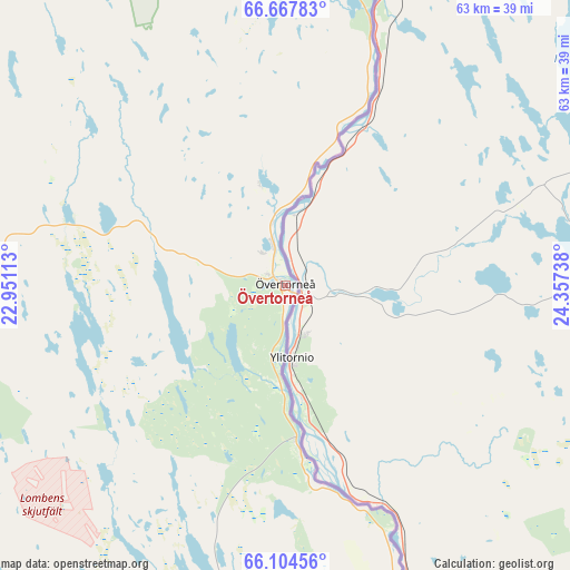
Övertorneå GPS coordinates[2]
66° 23' 16.008" North, 23° 39' 15.3" East
| Map corner | latitude | longitude |
|---|---|---|
| Upper-left | 66.66783°, | 22.95113° |
| Center: | 66.38778°, | 23.65425° |
| Lower-right: | 66.10456°, | 24.35738° |
| Map W x H: | 62.6×62.6 km | = 38.9×38.9mi |
| max Lat: | 67.85572° ⇑0.8% North |
| Övertorneå: | 66.38778° |
| min Lat: | ⇓99.2% South 55.34337° |
| min Long | Övertorneå | max Long |
| 11.1712° | 23.65425° | 24.13676° |
| W 99.8%⇐ | ⇒0.2% E |
Elevation
Elevation of Övertorneå is 54 m = 177 ft, and this is 28.6 m = 94 ft below average elevation for this country.
| Max E: |
663 m = 2175 ft | 47.9% |
| Avg. | 82.6 m = 271 ft | |
| Övertorneå | 54 m = 177 ft | |
Min E: |
-1 m = -3 ft | 52.1% |
See also: Sweden elevation on elevation.city.
Geographical zone
Övertorneå is located in North temperate zone (between Tropic of Cancer and the Arctic Circle). Distance of this North polar circle is 19.5 km =12.1 mi to North.| Distance of | km | miles | from Övertorneå |
|---|---|---|---|
| North Pole | 2625.4 | 1631.3 | to North |
| Arctic Circle | 19.5 | 12.1 | to North |
| Tropic Cancer | 4775.7 | 2967.5 | to South |
| Equator | 7381.6 | 4586.7 | to South |


Nearby cities:
15 places around Övertorneå: (largest is in red/bold)
• Bensbyn
104.7 km =65.1 mi,  217°
217°
• Haparanda
65.1 km =40.5 mi,  160°
160°
• Kalix
63.5 km =39.5 mi,  200°
200°
• Korpilombolo
58 km =36 mi,  332°
332°
• Långvik
70.4 km =43.7 mi,  244°
244°
• Marielund
62.8 km =39 mi, 161°
• Nyborg
70.3 km =43.7 mi, 196°
• Pajala
92.6 km =57.5 mi,  352°
352°
• Risögrund
66.7 km =41.4 mi, 196°
• Rolfs
64.5 km =40.1 mi, 202°
• Rutvik
106.5 km =66.2 mi, 221°
• Råneå
85.3 km =53 mi,  225°
225°
• Sangis
59.6 km =37 mi,  186°
186°
• Töre
69.5 km =43.2 mi, 220°
• Överkalix
36.7 km =22.8 mi,  259°
259°
Sources, notices
• [Note1] Compared only with cities in Sweden existing in our database
• [Src1] Map data: © OpenStreetMap contributors (CC-BY-SA)
• [Src2] Other city data from geonames.org with taken over terms of usage.
• [Src3] Geographical zone / Annual Mean Temperature by Robert A. Rohde @ Wikipedia
