Ljubno ob Savinji geodata
Ljubno ob Savinji (Ljubno) is a seat of a first-order administrative division; located in Slovenia in Europe/Ljubljana (GMT+2) time zone. With population of 1,104 people, there are 195 cities with bigger population in this country. Compared to other cities in Slovenia, 59.2% of cities are located further ↓South; 54.5% of cities are located further →East and 79.5% of cities have lower elevation than Ljubno ob Savinji. Note1


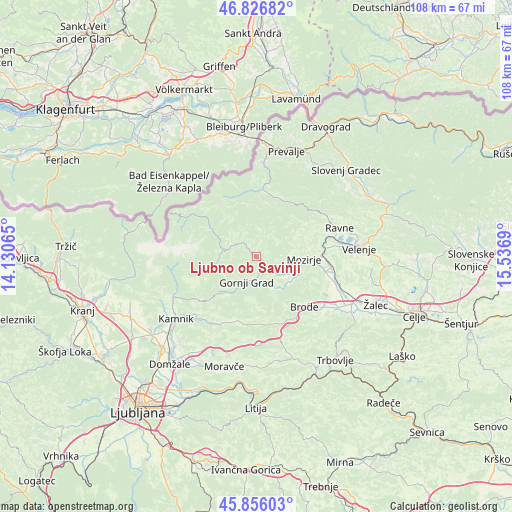
Ljubno ob Savinji GPS coordinates[2]
46° 20' 36.888" North, 14° 50' 1.572" East
| Map corner | latitude | longitude |
|---|---|---|
| Upper-left | 46.82682°, | 14.13065° |
| Center: | 46.34358°, | 14.83377° |
| Lower-right: | 45.85603°, | 15.5369° |
| Map W x H: | 107.9×107.9 km | = 67×67mi |
| max Lat: | 46.83694° ⇑40.8% North |
| Ljubno ob Savinji: | 46.34358° |
| min Lat: | ⇓59.2% South 45.47667° |
| min Long | Ljubno ob Savin | max Long |
| 13.52639° | 14.83377° | 16.4975° |
| W 45.5%⇐ | ⇒54.5% E |
Elevation
Elevation of Ljubno ob Savinji is 430 m = 1411 ft, and this is 104.4 m = 343 ft above average elevation for this country.
| Max E: |
1551 m = 5089 ft | 20.5% |
| Ljubno ob Savinji | 430 m 1411 ft | |
| Avg. | 325.6 m = 1068 ft | |
Min E: |
2 m = 7 ft | 79.5% |
See also: Slovenia elevation on elevation.city.
Geographical zone
Ljubno ob Savinji is located in North temperate zone (between Tropic of Cancer and the Arctic Circle). Distance of this North polar circle is 2248.3 km =1397 mi to North.| Distance of | km | miles | from Ljubno ob Savinji |
|---|---|---|---|
| North Pole | 4854.1 | 3016.2 | to North |
| Arctic Circle | 2248.3 | 1397 | to North |
| Tropic Cancer | 2547 | 1582.6 | to South |
| Equator | 5152.9 | 3201.9 | to South |


Nearby cities:
15 places around Ljubno ob Savinji: (largest is in red/bold)
• Bočna
6.2 km =3.9 mi,  164°
164°
• Florjan
14.5 km =9 mi,  67°
67°
• Gornji Grad
5.7 km =3.5 mi,  199°
199°
• Letuš
15 km =9.3 mi,  101°
101°
• Lokovica
16.8 km =10.4 mi,  83°
83°
• Luče
6.8 km =4.2 mi,  281°
281°
• Mozirje
10 km =6.2 mi,  92°
92°
• Nazarje
9.1 km =5.7 mi,  108°
108°
• Nova Štifta
10 km =6.2 mi,  220°
220°
• Rečica ob Savinji
7 km =4.3 mi,  115°
115°
• Solčava
13.7 km =8.5 mi,  308°
308°
• Topolšica
15.7 km =9.8 mi, 66°
• Vransko
14.3 km =8.9 mi,  140°
140°
• Črna na Koroškem
14.2 km =8.8 mi,  5°
5°
• Šmartno ob Paki
15.4 km =9.6 mi, 94°
Sources, notices
• [Note1] Compared only with cities in Slovenia existing in our database
• [Src1] Map data: © OpenStreetMap contributors (CC-BY-SA)
• [Src2] Other city data from geonames.org with taken over terms of usage.
• [Src3] Geographical zone / Annual Mean Temperature by Robert A. Rohde @ Wikipedia
