Martjanci geodata
Martjanci (Moravske Toplice) is a populated place; located in Slovenia in Europe/Ljubljana (GMT+2) time zone. With population of 539 people, there are 497 cities with bigger population in this country. Compared to other cities in Slovenia, 98% of cities are located further ↓South; 93.8% of cities are located further ←West and 82% of cities have higher elevation than Martjanci. Note1


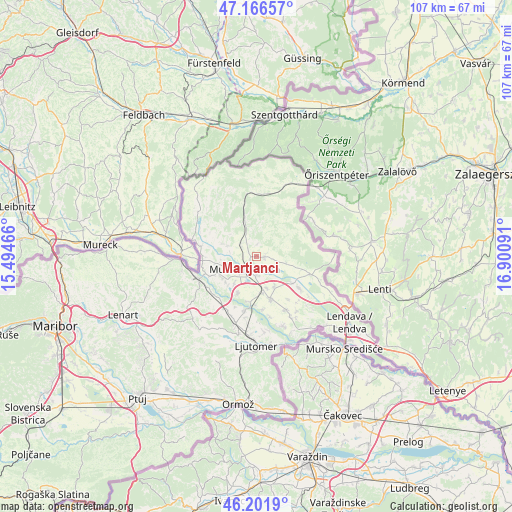
Martjanci GPS coordinates[2]
46° 41' 11.004" North, 16° 11' 52.008" East
| Map corner | latitude | longitude |
|---|---|---|
| Upper-left | 47.16657°, | 15.49466° |
| Center: | 46.68639°, | 16.19778° |
| Lower-right: | 46.2019°, | 16.90091° |
| Map W x H: | 107.3×107.3 km | = 66.7×66.7mi |
| max Lat: | 46.83694° ⇑2% North |
| Martjanci: | 46.68639° |
| min Lat: | ⇓98% South 45.47667° |
| min Long | Martjanci | max Long |
| 13.52639° | 16.19778° | 16.4975° |
| W 93.8%⇐ | ⇒6.2% E |
Elevation
Elevation of Martjanci is 190 m = 623 ft, and this is 135.6 m = 445 ft below average elevation for this country.
| Max E: |
1551 m = 5089 ft | 82% |
| Avg. | 325.6 m = 1068 ft | |
| Martjanci | 190 m = 623 ft | |
Min E: |
2 m = 7 ft | 18% |
See also: Slovenia elevation on elevation.city.
Geographical zone
Martjanci is located in North temperate zone (between Tropic of Cancer and the Arctic Circle). Distance of this North polar circle is 2210.1 km =1373.3 mi to North.| Distance of | km | miles | from Martjanci |
|---|---|---|---|
| North Pole | 4816 | 2992.5 | to North |
| Arctic Circle | 2210.1 | 1373.3 | to North |
| Tropic Cancer | 2585.1 | 1606.3 | to South |
| Equator | 5191 | 3225.5 | to South |


Nearby cities:
15 places around Martjanci: (largest is in red/bold)
• Bakovci
8.3 km =5.2 mi,  205°
205°
• Bogojina
6.7 km =4.2 mi,  99°
99°
• Bratonci
7.8 km =4.8 mi,  167°
167°
• Dokležovje
9.4 km =5.8 mi,  189°
189°
• Gančani
7.2 km =4.5 mi,  145°
145°
• Krog
6.9 km =4.3 mi,  218°
218°
• Lipovci
6.9 km =4.3 mi,  160°
160°
• Moravske Toplice
1.8 km =1.1 mi, 101°
• Murska Sobota
3.6 km =2.2 mi, 222°
• Puconci
3.9 km =2.4 mi,  305°
305°
• Pušča
5.6 km =3.5 mi,  232°
232°
• Rakičan
3.9 km =2.4 mi, 172°
• Tišina
8.7 km =5.4 mi,  248°
248°
• Tropovci
8.1 km =5 mi,  243°
243°
• Černelavci
5.4 km =3.4 mi, 245°
Sources, notices
• [Note1] Compared only with cities in Slovenia existing in our database
• [Src1] Map data: © OpenStreetMap contributors (CC-BY-SA)
• [Src2] Other city data from geonames.org with taken over terms of usage.
• [Src3] Geographical zone / Annual Mean Temperature by Robert A. Rohde @ Wikipedia
