Puconci geodata
Puconci is a seat of a first-order administrative division; located in Slovenia in Europe/Ljubljana (GMT+2) time zone. With population of 638 people, there are 403 cities with bigger population in this country. Compared to other cities in Slovenia, 98.7% of cities are located further ↓South; 93% of cities are located further ←West and 79.2% of cities have higher elevation than Puconci. Note1


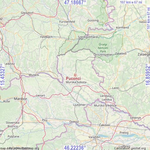
Puconci GPS coordinates[2]
46° 42' 24.012" North, 16° 9' 23.004" East
| Map corner | latitude | longitude |
|---|---|---|
| Upper-left | 47.18667°, | 15.45327° |
| Center: | 46.70667°, | 16.15639° |
| Lower-right: | 46.22236°, | 16.85952° |
| Map W x H: | 107.2×107.2 km | = 66.6×66.6mi |
| max Lat: | 46.83694° ⇑1.3% North |
| Puconci: | 46.70667° |
| min Lat: | ⇓98.7% South 45.47667° |
| min Long | Puconci | max Long |
| 13.52639° | 16.15639° | 16.4975° |
| W 93%⇐ | ⇒7% E |
Elevation
Elevation of Puconci is 205 m = 673 ft, and this is 120.6 m = 396 ft below average elevation for this country.
| Max E: |
1551 m = 5089 ft | 79.2% |
| Avg. | 325.6 m = 1068 ft | |
| Puconci | 205 m = 673 ft | |
Min E: |
2 m = 7 ft | 20.8% |
See also: Slovenia elevation on elevation.city.
Geographical zone
Puconci is located in North temperate zone (between Tropic of Cancer and the Arctic Circle). Distance of this North polar circle is 2207.9 km =1371.9 mi to North.| Distance of | km | miles | from Puconci |
|---|---|---|---|
| North Pole | 4813.8 | 2991.2 | to North |
| Arctic Circle | 2207.9 | 1371.9 | to North |
| Tropic Cancer | 2587.4 | 1607.7 | to South |
| Equator | 5193.3 | 3227 | to South |


Nearby cities:
15 places around Puconci: (largest is in red/bold)
• Bakovci
9.8 km =6.1 mi,  182°
182°
• Bogojina
10.3 km =6.4 mi,  109°
109°
• Cankova
10.3 km =6.4 mi,  278°
278°
• Gančani
11 km =6.8 mi,  138°
138°
• Krog
7.7 km =4.8 mi,  188°
188°
• Lipovci
10.3 km =6.4 mi,  147°
147°
• Martjanci
3.9 km =2.4 mi,  125°
125°
• Moravske Toplice
5.6 km =3.5 mi,  118°
118°
• Murska Sobota
5 km =3.1 mi,  171°
171°
• Petanjci
9.1 km =5.7 mi,  229°
229°
• Pušča
5.8 km =3.6 mi, 193°
• Rakičan
7.1 km =4.4 mi, 149°
• Tišina
7.3 km =4.5 mi,  222°
222°
• Tropovci
7.2 km =4.5 mi,  214°
214°
• Černelavci
4.8 km =3 mi,  201°
201°
Sources, notices
• [Note1] Compared only with cities in Slovenia existing in our database
• [Src1] Map data: © OpenStreetMap contributors (CC-BY-SA)
• [Src2] Other city data from geonames.org with taken over terms of usage.
• [Src3] Geographical zone / Annual Mean Temperature by Robert A. Rohde @ Wikipedia
