Kočevje geodata
Kočevje is a seat of a first-order administrative division; located in Slovenia in Europe/Ljubljana (GMT+2) time zone. With population of 8,672 people, there are 18 cities with bigger population in this country. Compared to other cities in Slovenia, 92.8% of cities are located further ↑North; 53.5% of cities are located further →East and 85% of cities have lower elevation than Kočevje. Note1


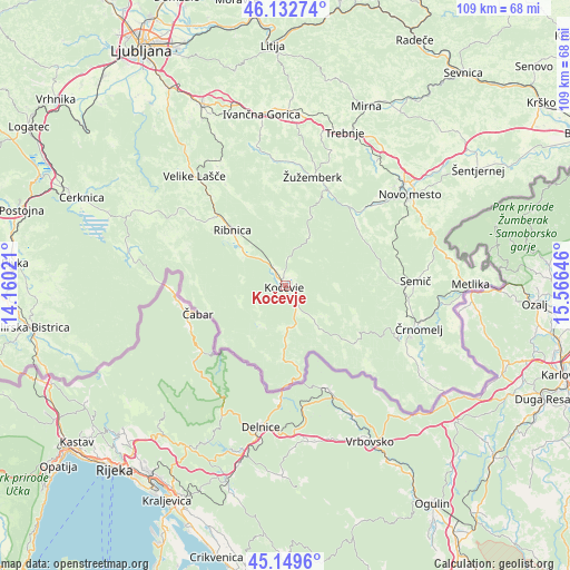
Kočevje GPS coordinates[2]
45° 38' 35.988" North, 14° 51' 47.988" East
| Map corner | latitude | longitude |
|---|---|---|
| Upper-left | 46.13274°, | 14.16021° |
| Center: | 45.64333°, | 14.86333° |
| Lower-right: | 45.1496°, | 15.56646° |
| Map W x H: | 109.3×109.3 km | = 67.9×67.9mi |
| max Lat: | 46.83694° ⇑92.8% North |
| Kočevje: | 45.64333° |
| min Lat: | ⇓7.2% South 45.47667° |
| min Long | Kočevje | max Long |
| 13.52639° | 14.86333° | 16.4975° |
| W 46.5%⇐ | ⇒53.5% E |
Elevation
Elevation of Kočevje is 471 m = 1545 ft, and this is 145.4 m = 477 ft above average elevation for this country.
| Max E: |
1551 m = 5089 ft | 15% |
| Kočevje | 471 m 1545 ft | |
| Avg. | 325.6 m = 1068 ft | |
Min E: |
2 m = 7 ft | 85% |
See also: Slovenia elevation on elevation.city.
Geographical zone
Kočevje is located in North temperate zone (between Tropic of Cancer and the Arctic Circle). Distance of this North polar circle is 2326.1 km =1445.4 mi to North.| Distance of | km | miles | from Kočevje |
|---|---|---|---|
| North Pole | 4932 | 3064.6 | to North |
| Arctic Circle | 2326.1 | 1445.4 | to North |
| Tropic Cancer | 2469.1 | 1534.2 | to South |
| Equator | 5075.1 | 3153.5 | to South |


Nearby cities:
15 places around Kočevje: (largest is in red/bold)
• Dolenja Vas
11 km =6.8 mi,  309°
309°
• Dolenjske Toplice
19.7 km =12.2 mi,  50°
50°
• Dolga Vas
3.4 km =2.1 mi,  150°
150°
• Hrib-Loški Potok
20.4 km =12.7 mi,  290°
290°
• Kostel
15.4 km =9.6 mi,  166°
166°
• Lokve
24.6 km =15.3 mi,  100°
100°
• Loški Potok
22.9 km =14.2 mi, 286°
• Osilnica
18.1 km =11.2 mi,  225°
225°
• Ribnica
15 km =9.3 mi,  315°
315°
• Sodražica
22 km =13.7 mi, 306°
• Straža
22.3 km =13.9 mi, 46°
• Uršna Sela
22 km =13.7 mi,  67°
67°
• Šalka Vas
1.9 km =1.2 mi, 53°
• Željne
2.5 km =1.6 mi, 46°
• Žužemberk
21.8 km =13.5 mi,  13°
13°
Sources, notices
• [Note1] Compared only with cities in Slovenia existing in our database
• [Src1] Map data: © OpenStreetMap contributors (CC-BY-SA)
• [Src2] Other city data from geonames.org with taken over terms of usage.
• [Src3] Geographical zone / Annual Mean Temperature by Robert A. Rohde @ Wikipedia
