Dolga Vas geodata
Dolga Vas (Kočevje) is a populated place; located in Slovenia in Europe/Ljubljana (GMT+2) time zone. With population of 829 people, there are 280 cities with bigger population in this country. Compared to other cities in Slovenia, 93.2% of cities are located further ↑North; 53.2% of cities are located further →East and 83.8% of cities have lower elevation than Dolga Vas. Note1


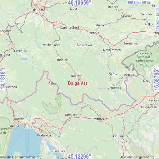
Dolga Vas GPS coordinates[2]
45° 37' 0.984" North, 14° 53' 4.992" East
| Map corner | latitude | longitude |
|---|---|---|
| Upper-left | 46.10659°, | 14.1816° |
| Center: | 45.61694°, | 14.88472° |
| Lower-right: | 45.12298°, | 15.58785° |
| Map W x H: | 109.4×109.4 km | = 68×68mi |
| max Lat: | 46.83694° ⇑93.2% North |
| Dolga Vas: | 45.61694° |
| min Lat: | ⇓6.8% South 45.47667° |
| min Long | Dolga Vas | max Long |
| 13.52639° | 14.88472° | 16.4975° |
| W 46.8%⇐ | ⇒53.2% E |
Elevation
Elevation of Dolga Vas is 461 m = 1512 ft, and this is 135.4 m = 444 ft above average elevation for this country.
| Max E: |
1551 m = 5089 ft | 16.2% |
| Dolga Vas | 461 m 1512 ft | |
| Avg. | 325.6 m = 1068 ft | |
Min E: |
2 m = 7 ft | 83.8% |
See also: Slovenia elevation on elevation.city.
Geographical zone
Dolga Vas is located in North temperate zone (between Tropic of Cancer and the Arctic Circle). Distance of this North polar circle is 2329 km =1447.2 mi to North.| Distance of | km | miles | from Dolga Vas |
|---|---|---|---|
| North Pole | 4934.9 | 3066.4 | to North |
| Arctic Circle | 2329 | 1447.2 | to North |
| Tropic Cancer | 2466.2 | 1532.4 | to South |
| Equator | 5072.1 | 3151.7 | to South |


Nearby cities:
15 places around Dolga Vas: (largest is in red/bold)
• Dolenja Vas
14.2 km =8.8 mi,  314°
314°
• Dolenjske Toplice
20.6 km =12.8 mi,  41°
41°
• Hrib-Loški Potok
23.1 km =14.4 mi,  295°
295°
• Kanižarica
23.2 km =14.4 mi,  108°
108°
• Kostel
12.2 km =7.6 mi,  170°
170°
• Kočevje
3.4 km =2.1 mi,  330°
330°
• Lokve
22.6 km =14 mi,  94°
94°
• Osilnica
17.5 km =10.9 mi,  236°
236°
• Ribnica
18.2 km =11.3 mi,  317°
317°
• Semič
23.4 km =14.5 mi,  82°
82°
• Straža
23.3 km =14.5 mi, 38°
• Uršna Sela
21.9 km =13.6 mi,  58°
58°
• Črnomelj
24.2 km =15 mi,  102°
102°
• Šalka Vas
4 km =2.5 mi,  357°
357°
• Željne
4.6 km =2.9 mi,  1°
1°
Sources, notices
• [Note1] Compared only with cities in Slovenia existing in our database
• [Src1] Map data: © OpenStreetMap contributors (CC-BY-SA)
• [Src2] Other city data from geonames.org with taken over terms of usage.
• [Src3] Geographical zone / Annual Mean Temperature by Robert A. Rohde @ Wikipedia
