Hotedršica geodata
Hotedršica (Logatec) is a populated place; located in Slovenia in Europe/Ljubljana (GMT+2) time zone. With population of 598 people, there are 441 cities with bigger population in this country. Compared to other cities in Slovenia, 80.7% of cities are located further ↑North; 83.2% of cities are located further →East and 91.5% of cities have lower elevation than Hotedršica. Note1


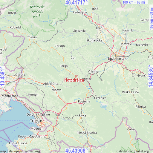
Hotedršica GPS coordinates[2]
45° 55' 49.008" North, 14° 8' 31.992" East
| Map corner | latitude | longitude |
|---|---|---|
| Upper-left | 46.41717°, | 13.4391° |
| Center: | 45.93028°, | 14.14222° |
| Lower-right: | 45.43908°, | 14.84535° |
| Map W x H: | 108.8×108.8 km | = 67.6×67.6mi |
| max Lat: | 46.83694° ⇑80.7% North |
| Hotedršica: | 45.93028° |
| min Lat: | ⇓19.3% South 45.47667° |
| min Long | Hotedršica | max Long |
| 13.52639° | 14.14222° | 16.4975° |
| W 16.8%⇐ | ⇒83.2% E |
Elevation
Elevation of Hotedršica is 546 m = 1791 ft, and this is 220.4 m = 723 ft above average elevation for this country.
| Max E: |
1551 m = 5089 ft | 8.5% |
| Hotedršica | 546 m 1791 ft | |
| Avg. | 325.6 m = 1068 ft | |
Min E: |
2 m = 7 ft | 91.5% |
See also: Slovenia elevation on elevation.city.
Geographical zone
Hotedršica is located in North temperate zone (between Tropic of Cancer and the Arctic Circle). Distance of this North polar circle is 2294.2 km =1425.5 mi to North.| Distance of | km | miles | from Hotedršica |
|---|---|---|---|
| North Pole | 4900.1 | 3044.8 | to North |
| Arctic Circle | 2294.2 | 1425.5 | to North |
| Tropic Cancer | 2501 | 1554 | to South |
| Equator | 5107 | 3173.3 | to South |


Nearby cities:
15 places around Hotedršica: (largest is in red/bold)
• Godovič
4.8 km =3 mi,  309°
309°
• Idrija
11.8 km =7.3 mi, 313°
• Kalce
5.5 km =3.4 mi,  134°
134°
• Logatec
6.7 km =4.2 mi,  105°
105°
• Planina
14 km =8.7 mi,  143°
143°
• Rovte
6.7 km =4.2 mi,  24°
24°
• Sinja Gorica
14.5 km =9 mi,  69°
69°
• Spodnja Idrija
14.4 km =8.9 mi,  321°
321°
• Stara Vrhnika
11.8 km =7.3 mi, 65°
• Verd
13 km =8.1 mi,  76°
76°
• Vrhnika
12.4 km =7.7 mi, 72°
• Vrhpolje
15.8 km =9.8 mi,  242°
242°
• Vrzdenec
14.1 km =8.8 mi,  44°
44°
• Črni Vrh
7.7 km =4.8 mi,  264°
264°
• Žiri
12.7 km =7.9 mi,  347°
347°
Sources, notices
• [Note1] Compared only with cities in Slovenia existing in our database
• [Src1] Map data: © OpenStreetMap contributors (CC-BY-SA)
• [Src2] Other city data from geonames.org with taken over terms of usage.
• [Src3] Geographical zone / Annual Mean Temperature by Robert A. Rohde @ Wikipedia
