Holíč geodata
Holíč (Trnavský kraj) is a populated place; located in Slovakia in Europe/Bratislava (GMT+2) time zone. With population of 11,416 people, there are 62 cities with bigger population in this country. Compared to other cities in Slovakia, 54.7% of cities are located further ↓South; 96.5% of cities are located further →East and 71.2% of cities have higher elevation than Holíč. Note1


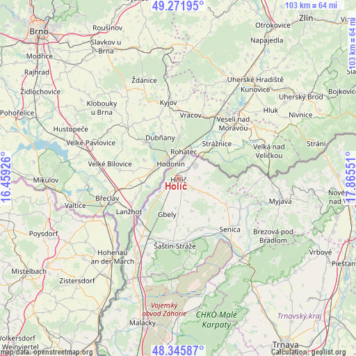
Holíč GPS coordinates[2]
48° 48' 39.78" North, 17° 9' 44.568" East
| Map corner | latitude | longitude |
|---|---|---|
| Upper-left | 49.27195°, | 16.45926° |
| Center: | 48.81105°, | 17.16238° |
| Lower-right: | 48.34587°, | 17.86551° |
| Map W x H: | 103×103 km | = 64×64mi |
| max Lat: | 49.43503° ⇑45.3% North |
| Holíč: | 48.81105° |
| min Lat: | ⇓54.7% South 47.76356° |
| min Long | Holíč | max Long |
| 16.9786° | 17.16238° | 22.18136° |
| W 3.5%⇐ | ⇒96.5% E |
Elevation
Elevation of Holíč is 180 m = 591 ft, and this is 156.1 m = 512 ft below average elevation for this country.
| Max E: |
1006 m = 3301 ft | 71.2% |
| Avg. | 336.1 m = 1103 ft | |
| Holíč | 180 m = 591 ft | |
Min E: |
102 m = 335 ft | 28.8% |
See also: Slovakia elevation on elevation.city.
Geographical zone
Holíč is located in North temperate zone (between Tropic of Cancer and the Arctic Circle). Distance of this North polar circle is 1973.9 km =1226.5 mi to North.| Distance of | km | miles | from Holíč |
|---|---|---|---|
| North Pole | 4579.8 | 2845.8 | to North |
| Arctic Circle | 1973.9 | 1226.5 | to North |
| Tropic Cancer | 2821.4 | 1753.1 | to South |
| Equator | 5427.3 | 3372.4 | to South |


Nearby cities:
15 places around Holíč: (largest is in red/bold)
• Brezová pod Bradlom
32.1 km =19.9 mi,  120°
120°
• Gbely
10.9 km =6.8 mi,  198°
198°
• Malacky
43 km =26.7 mi,  193°
193°
• Modra
54.1 km =33.6 mi,  168°
168°
• Myjava
30.3 km =18.8 mi,  101°
101°
• Nové Mesto nad Váhom
49.3 km =30.6 mi, 96°
• Piešťany
54.3 km =33.7 mi, 116°
• Senica
21 km =13 mi,  134°
134°
• Skalica
6 km =3.7 mi,  51°
51°
• Smolenice
39.3 km =24.4 mi,  149°
149°
• Stará Turá
39.1 km =24.3 mi, 95°
• Trnava
57.5 km =35.7 mi, 147°
• Vinosady
56.3 km =35 mi, 170°
• Vrbové
46.3 km =28.8 mi, 117°
• Čachtice
47.1 km =29.3 mi, 103°
Sources, notices
• [Note1] Compared only with cities in Slovakia existing in our database
• [Src1] Map data: © OpenStreetMap contributors (CC-BY-SA)
• [Src2] Other city data from geonames.org with taken over terms of usage.
• [Src3] Geographical zone / Annual Mean Temperature by Robert A. Rohde @ Wikipedia
