Gabčíkovo geodata
Gabčíkovo (Trnavský kraj) is a populated place; located in Slovakia in Europe/Bratislava (GMT+2) time zone. With population of 5,343 people, there are 107 cities with bigger population in this country. Compared to other cities in Slovakia, 97.1% of cities are located further ↑North; 87.6% of cities are located further →East and 94.7% of cities have higher elevation than Gabčíkovo. Note1
Administrative division(s):
- Level 1: Trnavský kraj
- Level 2: Okres Dunajská Streda
- Level 3: Gabčíkovo


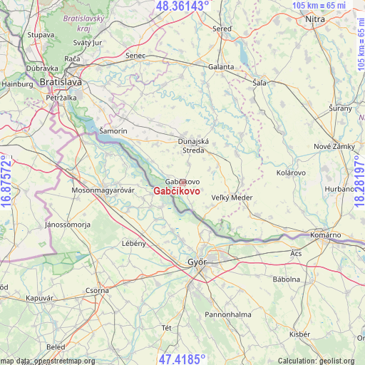
Gabčíkovo GPS coordinates[2]
47° 53' 31.596" North, 17° 34' 43.824" East
| Map corner | latitude | longitude |
|---|---|---|
| Upper-left | 48.36143°, | 16.87572° |
| Center: | 47.89211°, | 17.57884° |
| Lower-right: | 47.4185°, | 18.28197° |
| Map W x H: | 104.8×104.8 km | = 65.1×65.1mi |
| max Lat: | 49.43503° ⇑97.1% North |
| Gabčíkovo: | 47.89211° |
| min Lat: | ⇓2.9% South 47.76356° |
| min Long | Gabčíkovo | max Long |
| 16.9786° | 17.57884° | 22.18136° |
| W 12.4%⇐ | ⇒87.6% E |
Elevation
Elevation of Gabčíkovo is 116 m = 381 ft, and this is 220.1 m = 722 ft below average elevation for this country.
| Max E: |
1006 m = 3301 ft | 94.7% |
| Avg. | 336.1 m = 1103 ft | |
| Gabčíkovo | 116 m = 381 ft | |
Min E: |
102 m = 335 ft | 5.3% |
See also: Slovakia elevation on elevation.city.
Geographical zone
Gabčíkovo is located in North temperate zone (between Tropic of Cancer and the Arctic Circle). Distance of this North polar circle is 2076.1 km =1290 mi to North.| Distance of | km | miles | from Gabčíkovo |
|---|---|---|---|
| North Pole | 4682 | 2909.3 | to North |
| Arctic Circle | 2076.1 | 1290 | to North |
| Tropic Cancer | 2719.2 | 1689.6 | to South |
| Equator | 5325.1 | 3308.9 | to South |


Nearby cities:
15 places around Gabčíkovo: (largest is in red/bold)
• Bratislava
45.2 km =28.1 mi,  309°
309°
• Bratislava - Vajnory
44.5 km =27.7 mi,  321°
321°
• Dunajská Lužná
31.8 km =19.8 mi, 311°
• Dunajská Streda
11.5 km =7.1 mi,  12°
12°
• Galanta
34.9 km =21.7 mi,  18°
18°
• Ivanka pri Dunaji
40.6 km =25.2 mi, 323°
• Kolárovo
30.4 km =18.9 mi,  83°
83°
• Komárno
43 km =26.7 mi,  109°
109°
• Nové Zámky
44.7 km =27.8 mi, 76°
• Senec
38.7 km =24 mi,  339°
339°
• Sládkovičovo
34.7 km =21.6 mi, 7°
• Veľký Meder
14.7 km =9.1 mi,  104°
104°
• Vágfüzes
35.6 km =22.1 mi, 97°
• Šamorín
25.2 km =15.7 mi, 307°
• Šaľa
36.5 km =22.7 mi,  37°
37°
Sources, notices
• [Note1] Compared only with cities in Slovakia existing in our database
• [Src1] Map data: © OpenStreetMap contributors (CC-BY-SA)
• [Src2] Other city data from geonames.org with taken over terms of usage.
• [Src3] Geographical zone / Annual Mean Temperature by Robert A. Rohde @ Wikipedia
