Zvolen geodata
Zvolen (Banskobystrický kraj) is a seat of a second-order administrative division; located in Slovakia in Europe/Bratislava (GMT+2) time zone. With population of 44,502 people, there are 11 cities with bigger population in this country. Compared to other cities in Slovakia, 67.6% of cities are located further ↑North; 52.4% of cities are located further ←West and 54.7% of cities have lower elevation than Zvolen. Note1


Zvolen GPS coordinates[2]
48° 34' 27.912" North, 19° 9' 11.664" East
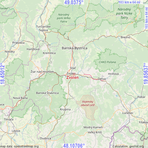
| Map corner | latitude | longitude |
|---|---|---|
| Upper-left | 49.0375°, | 18.45012° |
| Center: | 48.57442°, | 19.15324° |
| Lower-right: | 48.10706°, | 19.85637° |
| Map W x H: | 103.5×103.5 km | = 64.3×64.3mi |
| max Lat: | 49.43503° ⇑67.6% North |
| Zvolen: | 48.57442° |
| min Lat: | ⇓32.4% South 47.76356° |
| min Long | Zvolen | max Long |
| 16.9786° | 19.15324° | 22.18136° |
| W 52.4%⇐ | ⇒47.6% E |
Elevation
Elevation of Zvolen is 297 m = 974 ft, and this is 39.1 m = 128 ft below average elevation for this country.
| Max E: |
1006 m = 3301 ft | 45.3% |
| Avg. | 336.1 m = 1103 ft | |
| Zvolen | 297 m = 974 ft | |
Min E: |
102 m = 335 ft | 54.7% |
See also: Zvolen elevation on elevation.city.
Geographical zone
Zvolen is located in North temperate zone (between Tropic of Cancer and the Arctic Circle). Distance of this North polar circle is 2000.2 km =1242.9 mi to North.| Distance of | km | miles | from Zvolen |
|---|---|---|---|
| North Pole | 4606.1 | 2862.1 | to North |
| Arctic Circle | 2000.2 | 1242.9 | to North |
| Tropic Cancer | 2795.1 | 1736.8 | to South |
| Equator | 5401 | 3356 | to South |


Nearby cities:
15 places around Zvolen: (largest is in red/bold)
• Banská Bystrica
18.4 km =11.4 mi,  0°
0°
• Banská Štiavnica
22.7 km =14.1 mi,  232°
232°
• Detva
19.7 km =12.2 mi,  94°
94°
• Handlová
33.5 km =20.8 mi,  300°
300°
• Hriňová
27.4 km =17 mi, 89°
• Hrochoť,Slovakia
14.8 km =9.2 mi,  52°
52°
• Kováčová
4.8 km =3 mi,  308°
308°
• Kremnica
22.6 km =14 mi, 310°
• Krupina
25.2 km =15.7 mi,  194°
194°
• Svätý Anton
23.3 km =14.5 mi,  222°
222°
• Turčianske Teplice
38.5 km =23.9 mi,  326°
326°
• Voznica
35.8 km =22.2 mi,  249°
249°
• Čierny Balog
41.3 km =25.7 mi,  62°
62°
• Žarnovica
33.8 km =21 mi, 252°
• Žiar nad Hronom
22.4 km =13.9 mi,  274°
274°
Sources, notices
• [Note1] Compared only with cities in Slovakia existing in our database
• [Src1] Map data: © OpenStreetMap contributors (CC-BY-SA)
• [Src2] Other city data from geonames.org with taken over terms of usage.
• [Src3] Geographical zone / Annual Mean Temperature by Robert A. Rohde @ Wikipedia
