Thiès Nones geodata
Thiès Nones (Thiès) is a populated place; located in Senegal in Africa/Dakar (GMT+0) time zone. With population of 252,320 people, there are 4 cities with bigger population in this country. Compared to other cities in Senegal, 63.3% of cities are located further ↓South; 88.3% of cities are located further →East and 98.3% of cities have lower elevation than Thiès Nones. Note1


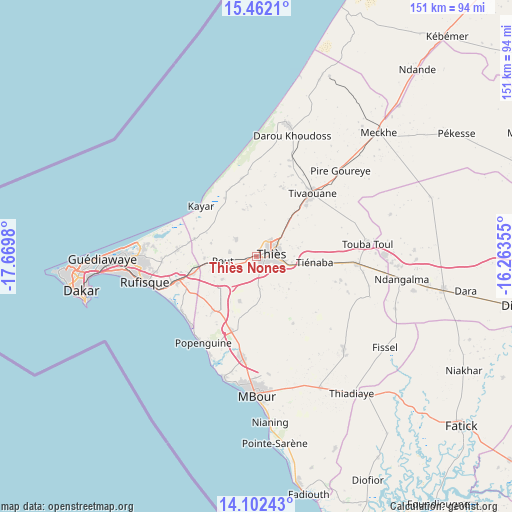
Thiès Nones GPS coordinates[2]
14° 46' 59.988" North, 16° 58' 0.012" West
| Map corner | latitude | longitude |
|---|---|---|
| Upper-left | 15.4621°, | -17.6698° |
| Center: | 14.78333°, | -16.96667° |
| Lower-right: | 14.10243°, | -16.26355° |
| Map W x H: | 151.2×151.2 km | = 94×94mi |
| max Lat: | 16.51293° ⇑36.7% North |
| Thiès Nones: | 14.78333° |
| min Lat: | ⇓63.3% South 12.485° |
| min Long | Thiès Nones | max Long |
| -17.47581° | -16.96667° | -12.18076° |
| W 11.7%⇐ | ⇒88.3% E |
Elevation
Elevation of Thiès Nones is 85 m = 279 ft, and this is 60.5 m = 198 ft above average elevation for this country.
| Max E: |
127 m = 417 ft | 1.7% |
| Thiès Nones | 85 m 279 ft | |
| Avg. | 24.5 m = 80 ft | |
Min E: |
0 m = 0 ft | 98.3% |
See also: Thiès Nones elevation on elevation.city.
Geographical zone
Thiès Nones is located in North Torrid zone (between Equator and Tropic of Cancer). Distance of this Northern Tropic circle is 962.2 km =597.9 mi to North.| Distance of | km | miles | from Thiès Nones |
|---|---|---|---|
| North Pole | 8363.3 | 5196.7 | to North |
| Arctic Circle | 5757.4 | 3577.5 | to North |
| Tropic Cancer | 962.2 | 597.9 | to North |
| Equator | 1643.8 | 1021.4 | to South |


Nearby cities:
15 places around Thiès Nones: (largest is in red/bold)
• Dakar
52.3 km =32.5 mi,  259°
259°
• Diofior
74.1 km =46 mi,  154°
154°
• Joal-Fadiout
70.1 km =43.6 mi,  168°
168°
• Kayar
22.3 km =13.9 mi,  312°
312°
• Khombole
28.7 km =17.8 mi,  93°
93°
• Mermoz Boabab
55.4 km =34.4 mi, 261°
• Mékhé
51.9 km =32.2 mi,  45°
45°
• Nguékhokh
30.4 km =18.9 mi,  187°
187°
• N’diareme limamoulaye
44.9 km =27.9 mi,  269°
269°
• Pikine
45.6 km =28.3 mi, 267°
• Pourham
76.3 km =47.4 mi,  129°
129°
• Pout
10.2 km =6.3 mi, 262°
• Thiès
4.4 km =2.7 mi,  81°
81°
• Tiadiaye
49.9 km =31 mi,  144°
144°
• Warang
45.6 km =28.3 mi,  176°
176°
Sources, notices
• [Note1] Compared only with cities in Senegal existing in our database
• [Src1] Map data: © OpenStreetMap contributors (CC-BY-SA)
• [Src2] Other city data from geonames.org with taken over terms of usage.
• [Src3] Geographical zone / Annual Mean Temperature by Robert A. Rohde @ Wikipedia
