Apastepeque geodata
Apastepeque (San Vicente) is a populated place; located in El Salvador in America/El_Salvador (GMT-6) time zone. With population of 5,785 people, there are 65 cities with bigger population in this country. Compared to other cities in El Salvador, 58% of cities are located further ↑North; 62% of cities are located further ←West and 67% of cities have lower elevation than Apastepeque. Note1


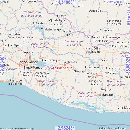
Apastepeque GPS coordinates[2]
13° 40' 0.012" North, 88° 46' 59.988" West
| Map corner | latitude | longitude |
|---|---|---|
| Upper-left | 14.34888°, | -89.48646° |
| Center: | 13.66667°, | -88.78333° |
| Lower-right: | 12.98248°, | -88.08021° |
| Map W x H: | 151.9×151.9 km | = 94.4×94.4mi |
| max Lat: | 14.33333° ⇑58% North |
| Apastepeque: | 13.66667° |
| min Lat: | ⇓42% South 13.19694° |
| min Long | Apastepeque | max Long |
| -90.01583° | -88.78333° | -87.83861° |
| W 62%⇐ | ⇒38% E |
Elevation
Elevation of Apastepeque is 623 m = 2044 ft, and this is 151.1 m = 496 ft above average elevation for this country.
| Max E: |
1255 m = 4117 ft | 33% |
| Apastepeque | 623 m 2044 ft | |
| Avg. | 471.9 m = 1548 ft | |
Min E: |
13 m = 43 ft | 67% |
See also: El Salvador elevation on elevation.city.
Geographical zone
Apastepeque is located in North Torrid zone (between Equator and Tropic of Cancer). Distance of this Northern Tropic circle is 1086.3 km =675 mi to North.| Distance of | km | miles | from Apastepeque |
|---|---|---|---|
| North Pole | 8487.5 | 5273.9 | to North |
| Arctic Circle | 5881.6 | 3654.7 | to North |
| Tropic Cancer | 1086.3 | 675 | to North |
| Equator | 1519.6 | 944.2 | to South |


Nearby cities:
15 places around Apastepeque: (largest is in red/bold)
• Berlín
32.8 km =20.4 mi,  124°
124°
• Cojutepeque
17.1 km =10.6 mi,  288°
288°
• El Rosario
32.6 km =20.3 mi,  234°
234°
• Ilopango
35.4 km =22 mi,  276°
276°
• San Agustín
32.6 km =20.3 mi,  142°
142°
• San Martín
19.4 km =12.1 mi,  312°
312°
• San Pedro Masahuat
30.8 km =19.1 mi,  243°
243°
• San Sebastián
9.2 km =5.7 mi,  323°
323°
• San Vicente
4.1 km =2.5 mi,  205°
205°
• Santiago Nonualco
24.5 km =15.2 mi, 227°
• Sensuntepeque
27.5 km =17.1 mi,  36°
36°
• Tecoluca
27.6 km =17.1 mi,  299°
299°
• Tenancingo
28.5 km =17.7 mi, 310°
• Victoria
35.4 km =22 mi,  27°
27°
• Zacatecoluca
20.6 km =12.8 mi, 205°
Sources, notices
• [Note1] Compared only with cities in El Salvador existing in our database
• [Src1] Map data: © OpenStreetMap contributors (CC-BY-SA)
• [Src2] Other city data from geonames.org with taken over terms of usage.
• [Src3] Geographical zone / Annual Mean Temperature by Robert A. Rohde @ Wikipedia
