Victoria geodata
Victoria (Cabañas) is a populated place; located in El Salvador in America/El_Salvador (GMT-6) time zone. With population of 2,023 people, there are 91 cities with bigger population in this country. Compared to other cities in El Salvador, 88% of cities are located further ↓South; 63% of cities are located further ←West and 93% of cities have lower elevation than Victoria. Note1


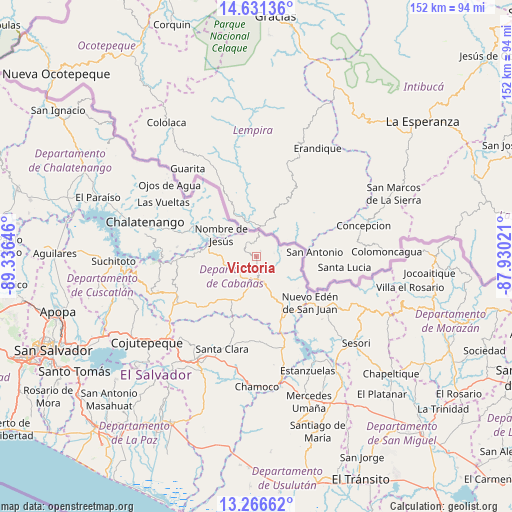
Victoria GPS coordinates[2]
13° 57' 0" North, 88° 37' 59.988" West
| Map corner | latitude | longitude |
|---|---|---|
| Upper-left | 14.63136°, | -89.33646° |
| Center: | 13.95°, | -88.63333° |
| Lower-right: | 13.26662°, | -87.93021° |
| Map W x H: | 151.7×151.7 km | = 94.3×94.3mi |
| max Lat: | 14.33333° ⇑12% North |
| Victoria: | 13.95° |
| min Lat: | ⇓88% South 13.19694° |
| min Long | Victoria | max Long |
| -90.01583° | -88.63333° | -87.83861° |
| W 63%⇐ | ⇒37% E |
Elevation
Elevation of Victoria is 879 m = 2884 ft, and this is 407.1 m = 1336 ft above average elevation for this country.
| Max E: |
1255 m = 4117 ft | 7% |
| Victoria | 879 m 2884 ft | |
| Avg. | 471.9 m = 1548 ft | |
Min E: |
13 m = 43 ft | 93% |
See also: El Salvador elevation on elevation.city.
Geographical zone
Victoria is located in North Torrid zone (between Equator and Tropic of Cancer). Distance of this Northern Tropic circle is 1054.8 km =655.4 mi to North.| Distance of | km | miles | from Victoria |
|---|---|---|---|
| North Pole | 8456 | 5254.3 | to North |
| Arctic Circle | 5850.1 | 3635.1 | to North |
| Tropic Cancer | 1054.8 | 655.4 | to North |
| Equator | 1551.1 | 963.8 | to South |


Nearby cities:
15 places around Victoria: (largest is in red/bold)
• Apastepeque
35.4 km =22 mi,  207°
207°
• Berlín
51.2 km =31.8 mi,  167°
167°
• Chalatenango
33.7 km =20.9 mi,  285°
285°
• Chapeltique
53 km =32.9 mi,  131°
131°
• Ciudad Barrios
44.5 km =27.7 mi,  117°
117°
• Cojutepeque
41.5 km =25.8 mi,  231°
231°
• San Francisco Morazán
51.9 km =32.2 mi,  299°
299°
• San Martín
35.8 km =22.2 mi,  238°
238°
• San Sebastián
32.4 km =20.1 mi,  221°
221°
• San Vicente
39.5 km =24.5 mi, 207°
• Sensuntepeque
9.3 km =5.8 mi,  180°
180°
• Sesori
38.8 km =24.1 mi, 132°
• Suchitoto
42.6 km =26.5 mi,  268°
268°
• Tecoluca
44 km =27.3 mi,  245°
245°
• Tenancingo
39.9 km =24.8 mi, 251°
Sources, notices
• [Note1] Compared only with cities in El Salvador existing in our database
• [Src1] Map data: © OpenStreetMap contributors (CC-BY-SA)
• [Src2] Other city data from geonames.org with taken over terms of usage.
• [Src3] Geographical zone / Annual Mean Temperature by Robert A. Rohde @ Wikipedia
