Sensuntepeque geodata
Sensuntepeque (Cabañas) is a seat of a first-order administrative division; located in El Salvador in America/El_Salvador (GMT-6) time zone. With population of 20,386 people, there are 25 cities with bigger population in this country. Compared to other cities in El Salvador, 79% of cities are located further ↓South; 63% of cities are located further ←West and 84% of cities have lower elevation than Sensuntepeque. Note1


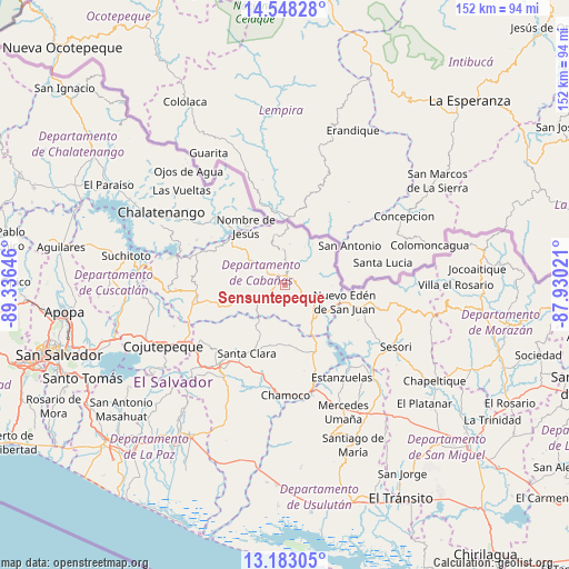
Sensuntepeque GPS coordinates[2]
13° 52' 0.012" North, 88° 37' 59.988" West
| Map corner | latitude | longitude |
|---|---|---|
| Upper-left | 14.54828°, | -89.33646° |
| Center: | 13.86667°, | -88.63333° |
| Lower-right: | 13.18305°, | -87.93021° |
| Map W x H: | 151.8×151.8 km | = 94.3×94.3mi |
| max Lat: | 14.33333° ⇑21% North |
| Sensuntepeque: | 13.86667° |
| min Lat: | ⇓79% South 13.19694° |
| min Long | Sensuntepeque | max Long |
| -90.01583° | -88.63333° | -87.83861° |
| W 63%⇐ | ⇒37% E |
Elevation
Elevation of Sensuntepeque is 734 m = 2408 ft, and this is 262.1 m = 860 ft above average elevation for this country.
| Max E: |
1255 m = 4117 ft | 16% |
| Sensuntepeque | 734 m 2408 ft | |
| Avg. | 471.9 m = 1548 ft | |
Min E: |
13 m = 43 ft | 84% |
See also: El Salvador elevation on elevation.city.
Geographical zone
Sensuntepeque is located in North Torrid zone (between Equator and Tropic of Cancer). Distance of this Northern Tropic circle is 1064.1 km =661.2 mi to North.| Distance of | km | miles | from Sensuntepeque |
|---|---|---|---|
| North Pole | 8465.2 | 5260 | to North |
| Arctic Circle | 5859.3 | 3640.8 | to North |
| Tropic Cancer | 1064.1 | 661.2 | to North |
| Equator | 1541.8 | 958 | to South |


Nearby cities:
15 places around Sensuntepeque: (largest is in red/bold)
• Apastepeque
27.5 km =17.1 mi,  216°
216°
• Berlín
42.2 km =26.2 mi,  165°
165°
• Chalatenango
37.3 km =23.2 mi,  299°
299°
• Ciudad Barrios
41.1 km =25.5 mi,  105°
105°
• Cojutepeque
36.4 km =22.6 mi,  242°
242°
• Lolotique
46.7 km =29 mi,  139°
139°
• San Martín
32 km =19.9 mi,  253°
253°
• San Sebastián
26.2 km =16.3 mi, 235°
• San Vicente
31.6 km =19.6 mi,  214°
214°
• Santiago de María
46.3 km =28.8 mi,  157°
157°
• Sesori
33.3 km =20.7 mi,  120°
120°
• Suchitoto
43.3 km =26.9 mi,  280°
280°
• Tecoluca
41.1 km =25.5 mi,  257°
257°
• Tenancingo
38 km =23.6 mi, 264°
• Victoria
9.3 km =5.8 mi,  0°
0°
Sources, notices
• [Note1] Compared only with cities in El Salvador existing in our database
• [Src1] Map data: © OpenStreetMap contributors (CC-BY-SA)
• [Src2] Other city data from geonames.org with taken over terms of usage.
• [Src3] Geographical zone / Annual Mean Temperature by Robert A. Rohde @ Wikipedia
