Acajutla geodata
Acajutla (Sonsonate) is a populated place; located in El Salvador in America/El_Salvador (GMT-6) time zone. With population of 22,763 people, there are 23 cities with bigger population in this country. Compared to other cities in El Salvador, 68% of cities are located further ↑North; 94% of cities are located further →East and 97% of cities have higher elevation than Acajutla. Note1


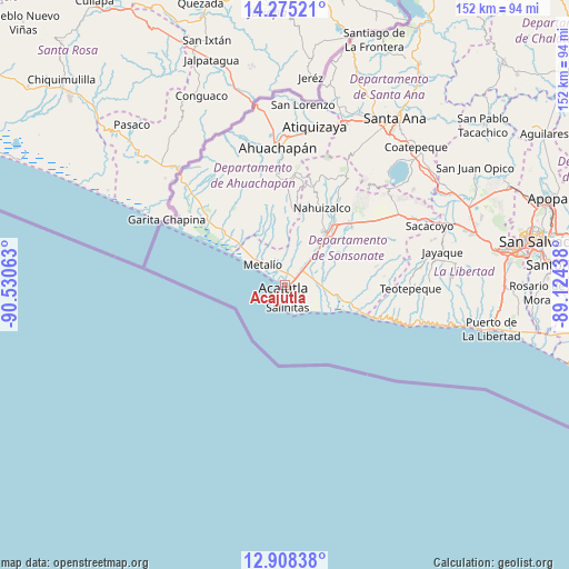
Acajutla GPS coordinates[2]
13° 35' 34.008" North, 89° 49' 39" West
| Map corner | latitude | longitude |
|---|---|---|
| Upper-left | 14.27521°, | -90.53063° |
| Center: | 13.59278°, | -89.8275° |
| Lower-right: | 12.90838°, | -89.12438° |
| Map W x H: | 152×152 km | = 94.4×94.4mi |
| max Lat: | 14.33333° ⇑68% North |
| Acajutla: | 13.59278° |
| min Lat: | ⇓32% South 13.19694° |
| min Long | Acajutla | max Long |
| -90.01583° | -89.8275° | -87.83861° |
| W 6%⇐ | ⇒94% E |
Elevation
Elevation of Acajutla is 26 m = 85 ft, and this is 445.9 m = 1463 ft below average elevation for this country.
| Max E: |
1255 m = 4117 ft | 97% |
| Avg. | 471.9 m = 1548 ft | |
| Acajutla | 26 m = 85 ft | |
Min E: |
13 m = 43 ft | 3% |
See also: El Salvador elevation on elevation.city.
Geographical zone
Acajutla is located in North Torrid zone (between Equator and Tropic of Cancer). Distance of this Northern Tropic circle is 1094.5 km =680.1 mi to North.| Distance of | km | miles | from Acajutla |
|---|---|---|---|
| North Pole | 8495.7 | 5279 | to North |
| Arctic Circle | 5889.8 | 3659.8 | to North |
| Tropic Cancer | 1094.5 | 680.1 | to North |
| Equator | 1511.4 | 939.1 | to South |


Nearby cities:
15 places around Acajutla: (largest is in red/bold)
• Ahuachapán
36.6 km =22.7 mi,  357°
357°
• Armenia
39.3 km =24.4 mi,  64°
64°
• Atiquizaya
43.5 km =27 mi,  10°
10°
• Chalchuapa
46.6 km =29 mi,  19°
19°
• Concepción de Ataco
30.9 km =19.2 mi, 355°
• Guaymango
17.6 km =10.9 mi,  354°
354°
• Izalco
23.7 km =14.7 mi,  44°
44°
• Juayúa
29 km =18 mi, 17°
• Jujutla
21.8 km =13.5 mi, 351°
• Nahuizalco
22.8 km =14.2 mi,  25°
25°
• San Antonio del Monte
16.8 km =10.4 mi, 35°
• San Francisco Menéndez
34.5 km =21.4 mi,  323°
323°
• Sonsonate
17.9 km =11.1 mi, 38°
• Sonzacate
19.9 km =12.4 mi, 37°
• Tacuba
36 km =22.4 mi,  342°
342°
Sources, notices
• [Note1] Compared only with cities in El Salvador existing in our database
• [Src1] Map data: © OpenStreetMap contributors (CC-BY-SA)
• [Src2] Other city data from geonames.org with taken over terms of usage.
• [Src3] Geographical zone / Annual Mean Temperature by Robert A. Rohde @ Wikipedia
