Ţafas geodata
Ţafas (Daraa) is a populated place; located in Syria in Asia/Damascus (GMT+3) time zone. With population of 31,249 people, there are 46 cities with bigger population in this country. Compared to other cities in Syria, 95.8% of cities are located further ↑North; 87.3% of cities are located further →East and 53.4% of cities have lower elevation than Ţafas. Note1


Ţafas GPS coordinates[2]
32° 44' 13.524" North, 36° 3' 59.544" East
| Map corner | latitude | longitude |
|---|---|---|
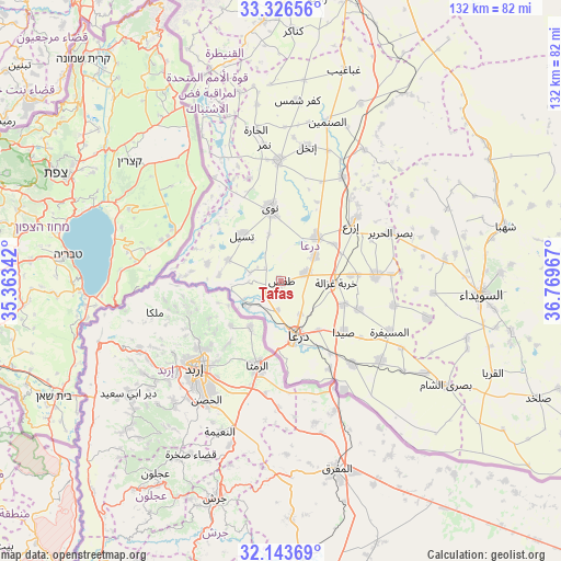
| Upper-left | 33.32656°, | 35.36342° |
| Center: | 32.73709°, | 36.06654° |
| Lower-right: | 32.14369°, | 36.76967° |
| Map W x H: | 131.5×131.5 km | = 81.7×81.7mi |
| max Lat: | 37.17701° ⇑95.8% North |
| Ţafas: | 32.73709° |
| min Lat: | ⇓4.2% South 32.39332° |
| min Long | Ţafas | max Long |
| 35.75572° | 36.06654° | 42.14006° |
| W 12.7%⇐ | ⇒87.3% E |
Elevation
Elevation of Ţafas is 489 m = 1604 ft, and this is 40.1 m = 132 ft below average elevation for this country.
| Max E: |
1640 m = 5381 ft | 46.6% |
| Avg. | 529.1 m = 1736 ft | |
| Ţafas | 489 m = 1604 ft | |
Min E: |
4 m = 13 ft | 53.4% |
See also: Syria elevation on elevation.city.
Geographical zone
Ţafas is located in North temperate zone (between Tropic of Cancer and the Arctic Circle). Distance of this Northern Tropic circle is 1034.1 km =642.6 mi to South.| Distance of | km | miles | from Ţafas |
|---|---|---|---|
| North Pole | 6367 | 3956.3 | to North |
| Arctic Circle | 3761.2 | 2337.1 | to North |
| Tropic Cancer | 1034.1 | 642.6 | to South |
| Equator | 3640 | 2261.8 | to South |


Nearby cities:
15 places around Ţafas: (largest is in red/bold)
• Al Jīzah
29.9 km =18.6 mi,  128°
128°
• Al Mazra‘ah
38.7 km =24 mi,  82°
82°
• Al Musayfirah
28.1 km =17.5 mi,  114°
114°
• Al Muzayrīb
4.7 km =2.9 mi,  231°
231°
• Al Ḩarāk
22.8 km =14.2 mi,  86°
86°
• Ash Shajarah
17.7 km =11 mi,  283°
283°
• Ash Shaykh Miskīn
13.4 km =8.3 mi,  40°
40°
• Dar‘ā
13.6 km =8.5 mi,  165°
165°
• Dā‘il
6.2 km =3.9 mi,  71°
71°
• Inkhil
31.8 km =19.8 mi,  10°
10°
• Izra‘
23 km =14.3 mi,  49°
49°
• Jāsim
28.4 km =17.6 mi,  358°
358°
• Khirbat Ghazālah
12.9 km =8 mi, 91°
• Nawá
17.2 km =10.7 mi,  351°
351°
• Tasīl
14.1 km =8.8 mi,  319°
319°
Sources, notices
• [Note1] Compared only with cities in Syria existing in our database
• [Src1] Map data: © OpenStreetMap contributors (CC-BY-SA)
• [Src2] Other city data from geonames.org with taken over terms of usage.
• [Src3] Geographical zone / Annual Mean Temperature by Robert A. Rohde @ Wikipedia
