Al Mazra‘ah geodata
Al Mazra‘ah (As-Suwayda) is a seat of a third-order administrative division; located in Syria in Asia/Damascus (GMT+3) time zone. In our database, there are 87 cities with bigger population. Compared to other cities in Syria, 94% of cities are located further ↑North; 57.6% of cities are located further →East and 84.1% of cities have lower elevation than Al Mazra‘ah. Note1


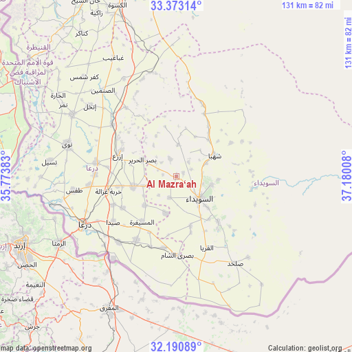
Al Mazra‘ah GPS coordinates[2]
32° 47' 2.328" North, 36° 28' 37.02" East
| Map corner | latitude | longitude |
|---|---|---|
| Upper-left | 33.37314°, | 35.77383° |
| Center: | 32.78398°, | 36.47695° |
| Lower-right: | 32.19089°, | 37.18008° |
| Map W x H: | 131.5×131.5 km | = 81.7×81.7mi |
| max Lat: | 37.17701° ⇑94% North |
| Al Mazra‘ah: | 32.78398° |
| min Lat: | ⇓6% South 32.39332° |
| min Long | Al Mazra‘ah | max Long |
| 35.75572° | 36.47695° | 42.14006° |
| W 42.4%⇐ | ⇒57.6% E |
Elevation
Elevation of Al Mazra‘ah is 800 m = 2625 ft, and this is 270.9 m = 889 ft above average elevation for this country.
| Max E: |
1640 m = 5381 ft | 15.9% |
| Al Mazra‘ah | 800 m 2625 ft | |
| Avg. | 529.1 m = 1736 ft | |
Min E: |
4 m = 13 ft | 84.1% |
See also: Syria elevation on elevation.city.
Geographical zone
Al Mazra‘ah is located in North temperate zone (between Tropic of Cancer and the Arctic Circle). Distance of this Northern Tropic circle is 1039.3 km =645.8 mi to South.| Distance of | km | miles | from Al Mazra‘ah |
|---|---|---|---|
| North Pole | 6361.8 | 3953 | to North |
| Arctic Circle | 3755.9 | 2333.8 | to North |
| Tropic Cancer | 1039.3 | 645.8 | to South |
| Equator | 3645.2 | 2265 | to South |


Nearby cities:
15 places around Al Mazra‘ah: (largest is in red/bold)
• Al Jīzah
28.3 km =17.6 mi,  212°
212°
• Al Musayfirah
21.2 km =13.2 mi,  217°
217°
• Al Mushannaf
28.3 km =17.6 mi,  100°
100°
• Al Qurayyā
29 km =18 mi,  157°
157°
• Al Ḩarāk
16.1 km =10 mi,  256°
256°
• As-Suwayda
12 km =7.5 mi,  133°
133°
• Ash Shaykh Miskīn
30.1 km =18.7 mi,  279°
279°
• Aş Şūrah aş Şaghīrah
29.1 km =18.1 mi,  18°
18°
• Buşrá ash Shām
29.3 km =18.2 mi,  178°
178°
• Izra‘
22.9 km =14.2 mi,  294°
294°
• Khirbat Ghazālah
26.1 km =16.2 mi, 257°
• Shahbā
16.3 km =10.1 mi,  60°
60°
• Shaqqā
24.1 km =15 mi, 58°
• Şalākhid
13.3 km =8.3 mi,  42°
42°
• ‘Arīqah
11.8 km =7.3 mi,  2°
2°
Sources, notices
• [Note1] Compared only with cities in Syria existing in our database
• [Src1] Map data: © OpenStreetMap contributors (CC-BY-SA)
• [Src2] Other city data from geonames.org with taken over terms of usage.
• [Src3] Geographical zone / Annual Mean Temperature by Robert A. Rohde @ Wikipedia
